


Following in the footsteps of the ancient pilgrims, we discover the Tuscan stages of the cultural itinerary that leads from Canterbury to Rome
The path of the Via Francigena is an important cultural itinerary that connects Canterbury and Rome and continues to excite those who travel across the limestone traces left over the centuries through the unspoiled landscape, taking in historical and artistic beauties along the way.
This historical European route that crosses Tuscany represents a unique opportunity to discover almost 400 km (divided into 16 stages) of the ancient route once travelled by pilgrims, merchants and travellers, through forests, hills and medieval villages, all the while encountering intriguing history, art, food and wine.
Tuscany from north to south
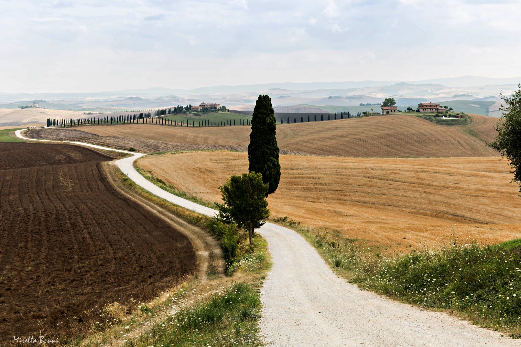
A journey along the Francigena reveals an incredible beauty, from the north to the south of Tuscany. From the wooded Lunigiana, which contains villages (treasures such as Pontremoli), parish churches and castles, up to Pietrasanta, and then descends to the valley as far as Lucca, go up from San Miniato and cross the hills until you see the towers of San Gimignano, pass Monteriggioni, enter Siena and then continue to the Amiata and Val D'Orcia, going up to Radicofani.
Three variants depart from the official route. The water variant is located along stage 29 and allows us to pass through Ponte Buggianese and Padule di Fucecchio; the second variant leads to the Abbey of Santa Maria Assunta in Coneo, deviating from stage 32, which connects San Gimignano to Monteriggioni; and the last one is the most well-known and touches the village of Abbadia San Salvatore by deviating from stage 36 (from San Quirico to Radicofani).

Let's discover some of the historical background. In 990, Sigerico, the Archbishop of Canterbury, went to Rome to receive the pallium - symbol of the pastoral mission - from the hands of the Pope. On the way back, he noted the stops of the journey in a travel diary thanks to which it was possible to reconstruct the route. However, the Lombards had formerly plotted the route in the 6th century as they crossed the Cisa pass, tracing a safe route to reach the historic seaport of Luni and Tuscia. Over the years, monuments and artistic treasures enriched the main points of a path that was able to link the Mediterranean area with the North Sea, thus contributing to the flourishing of European trade.
Today, the Francigena represents a wonderful journey (secular or spiritual) that is enriching as you encounter nature, culture and tradition treated with a conscious and respectful tourism.
The 22nd stage of the Francigena is the first in Tuscany. It marks the crossing of the Apennine ridge, not far from the current Cisa Pass, and the descent into the valley of the Magra river. The peaceful landscape features rich forests surrounded by castles, Romanesque churches and charming villages that lead to Pontremoli, with its palaces and Medieval churches, including that of San Pietro, where the "labyrinth" is still preserved today, a symbol of pilgrimages to the Holy Land.
The 22nd stage of the Francigena is the first in Tuscany. It marks the crossing of the Apennine ridge, not far from the current Cisa Pass, and the descent into the valley of the Magra river. The peaceful landscape features rich forests surrounded by castles, Romanesque churches and charming villages that lead to Pontremoli, with its palaces and Medieval churches, including that of San Pietro, where the "labyrinth" is still preserved today, a symbol of pilgrimages to the Holy Land.
- straighten
Length19,57 km
-
DifficultyVery demanding
- schedule
Duration5 ore
- trending_down
Descent1327 m
- trending_up
Ascent527 m
- vertical_align_top
Maximum altitude1108 m
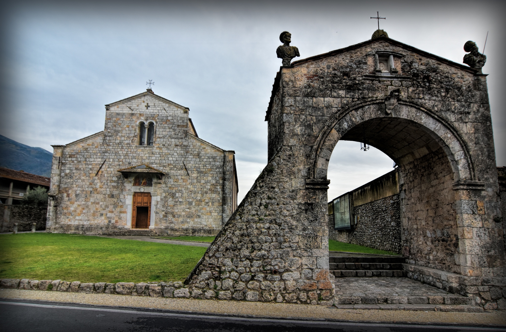
Following on from Pontremoli, a series of dirt roads and paths pass through long stretches in the woods. After having seen the elegant parish church of Sorano, the Francigena crosses the historic village of Filattiera. Along the valley of the Monia torrent, we reach Filetto and then Villafranca in Lunigiana, where you can visit the ethnographic museum. After crossing the Bagnone stream, going up to Virgoletta, the path reaches Terrarossa, dominated by the Malaspina castle, continuing up to the abbey of San Caprasio in Aulla, founded in 884.
Following on from Pontremoli, a series of dirt roads and paths pass through long stretches in the woods. After having seen the elegant parish church of Sorano, the Francigena crosses the historic village of Filattiera. Along the valley of the Monia torrent, we reach Filetto and then Villafranca in Lunigiana, where you can visit the ethnographic museum. After crossing the Bagnone stream, going up to Virgoletta, the path reaches Terrarossa, dominated by the Malaspina castle, continuing up to the abbey of San Caprasio in Aulla, founded in 884.
- straighten
Length32,12 km
-
DifficultyDemanding
- schedule
Duration7.20 ore
- trending_down
Descent565 m
- trending_up
Ascent386 m
- vertical_align_top
Maximum altitude250 m
Passing castles and fortresses along the Lunigiana hills (for example, Fosdinovo), the first part of the section takes place largely on a trail that offers a beautiful view of the Tyrrhenian Sea. Interesting the atmospheres of the ancient villages along the way, the view of the ruins of the Brina Castle and the town of Sarzana.
Passing castles and fortresses along the Lunigiana hills (for example, Fosdinovo), the first part of the section takes place largely on a trail that offers a beautiful view of the Tyrrhenian Sea. Interesting the atmospheres of the ancient villages along the way, the view of the ruins of the Brina Castle and the town of Sarzana.
- straighten
Length17,44 km
-
DifficultyAverage
- schedule
Duration5 ore
- trending_down
Descent646 m
- trending_up
Ascent608 m
- vertical_align_top
Maximum altitude539 m
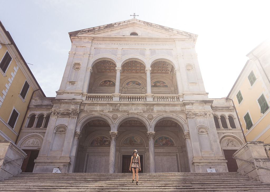
Leaving Sarzana, along a road among the vineyards that cover the hills, in a succession of panoramas of the Apuan Alps and the sea, the Francigena passes through the historic center of Massa, before going back up to Montignoso where the Aghinolfi castle stands on the hill. In Massa we recommend a visit to the Cathedral of Saints Peter and Francis and to the Diocesan museum.
Leaving Sarzana, along a road among the vineyards that cover the hills, in a succession of panoramas of the Apuan Alps and the sea, the Francigena passes through the historic center of Massa, before going back up to Montignoso where the Aghinolfi castle stands on the hill. In Massa we recommend a visit to the Cathedral of Saints Peter and Francis and to the Diocesan museum.
- straighten
Length28,49 km
-
DifficultyDemanding
- schedule
Duration7 ore
- trending_down
Descent544 m
- trending_up
Ascent586 m
Go up towards Aghinolfi Castle in Montignoso to take a panoramic road, which must be traveled with caution due to traffic. The section continues as far as Pietrasanta, "the little Athens of Italy", the adoptive homeland of artists from all over the world. Immediately after Pietrasanta and its beautiful Piazza Duomo, we can visit the historic Parish Church of San Giovanni, and continue up and down the hills of Lucca to the historic center of Camaiore and the centuries-old Abbey.
Go up towards Aghinolfi Castle in Montignoso to take a panoramic road, which must be traveled with caution due to traffic. The section continues as far as Pietrasanta, "the little Athens of Italy", the adoptive homeland of artists from all over the world. Immediately after Pietrasanta and its beautiful Piazza Duomo, we can visit the historic Parish Church of San Giovanni, and continue up and down the hills of Lucca to the historic center of Camaiore and the centuries-old Abbey.
- straighten
Length26 km
-
DifficultyAverage
- schedule
Duration6 ore
- trending_down
Descent412 m
- trending_up
Ascent410 m
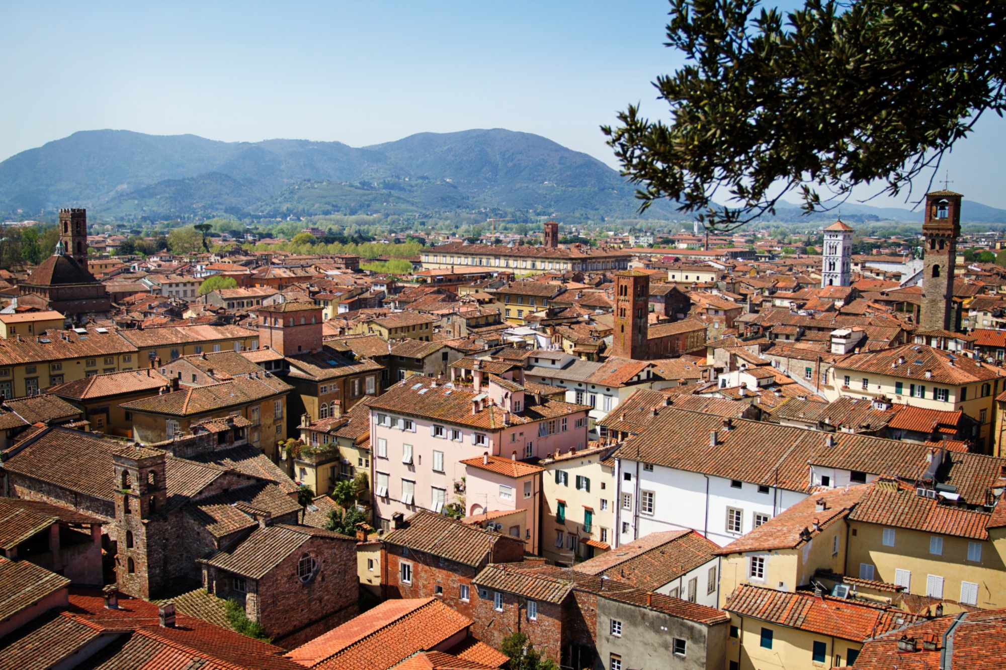
After visiting the historic center of Camaiore and the centuries-old Abbey, go up towards Monte Magno and through the Freddana valley, where you will reach Valpromaro. From here, a path through the woods leads to Piazzano. We then descend into the valley of the Contesola stream and, crossing the Serchio river at Ponte San Pietro, we soon arrive at Lucca, entering from the historic San Donato gate. In the Cathedral of San Martino is kept the Holy Face, destination of veneration of the path that bears his name. In Lucca, is also the Via Francigena Entry Point complex, which offers a series of services designed for slow and religious tourism.
After visiting the historic center of Camaiore and the centuries-old Abbey, go up towards Monte Magno and through the Freddana valley, where you will reach Valpromaro. From here, a path through the woods leads to Piazzano. We then descend into the valley of the Contesola stream and, crossing the Serchio river at Ponte San Pietro, we soon arrive at Lucca, entering from the historic San Donato gate. In the Cathedral of San Martino is kept the Holy Face, destination of veneration of the path that bears his name. In Lucca, is also the Via Francigena Entry Point complex, which offers a series of services designed for slow and religious tourism.
- straighten
Length24,88 km
-
DifficultyAverage
- schedule
Duration6 ore
- trending_down
Descent286 m
- trending_up
Ascent238 m
- vertical_align_top
Maximum altitude286 m
After Lucca, continue in the direction of the Arno river where the Francigena reaches Capannori, with its parish church of San Quirico with its thirteenth-century facade, then arriving at Porcari. From here, with a deviation of 500 meters, you reach Badia di Pozzeveri and then Altopascio, home of the "Spedale" of the Knights of the Tau, a safe refuge for pilgrims.
After Lucca, continue in the direction of the Arno river where the Francigena reaches Capannori, with its parish church of San Quirico with its thirteenth-century facade, then arriving at Porcari. From here, with a deviation of 500 meters, you reach Badia di Pozzeveri and then Altopascio, home of the "Spedale" of the Knights of the Tau, a safe refuge for pilgrims.
- straighten
Length18,6 km
-
DifficultyEasy
- schedule
Duration4 ore
- trending_down
Descent30 m
- trending_up
Ascent30 m
- vertical_align_top
Maximum altitude24 m
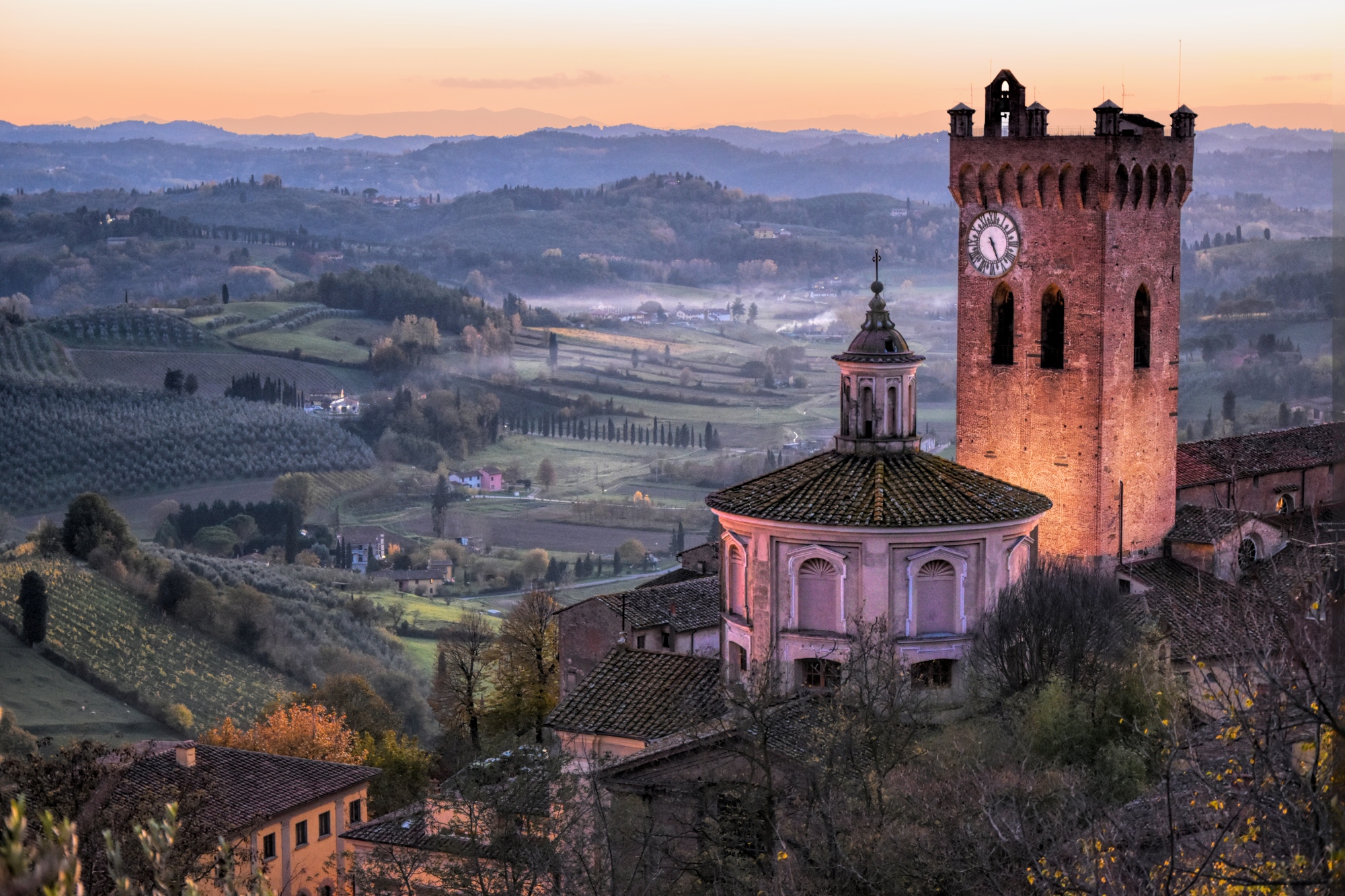
In the initial part of the route, in Galleno, you walk on the pavement of the ancient Via Francigena. You then pass the wild and deserted hills of the Cerbaie to head towards Ponte a Cappiano and its Medici bridge. From here along the embankment of the Usciana canal you cross an ancient marsh now reclaimed and go back to the historic center of Fucecchio, whose museum preserves splendid works of art. After passing the Arno, you will soon reach San Miniato, the powerful and rich medieval village known in the gastronomic field for the truffle.
A spectacular alternative route of the Via Francigena called the "water variant" departs from Altopascio. It crosses the canals and marshy areas of Padule di Fucecchio, a nature reserve rich in biodiversity and historical evidence, a paradise for birdwatchers, and then rejoins the main route at Ponte a Cappiano. A variant that can be traveled along the banks on foot, by bike, on horseback or aboard barchini (run by local associations), traditional boats that ply the waters of the marsh. Download the route of the Water Variant (kml).
- straighten
Length29,5 km
-
DifficultyDemanding
- schedule
Duration6 h
- trending_down
Descent173 m
- trending_up
Ascent283 m
- vertical_align_top
Maximum altitude130 m
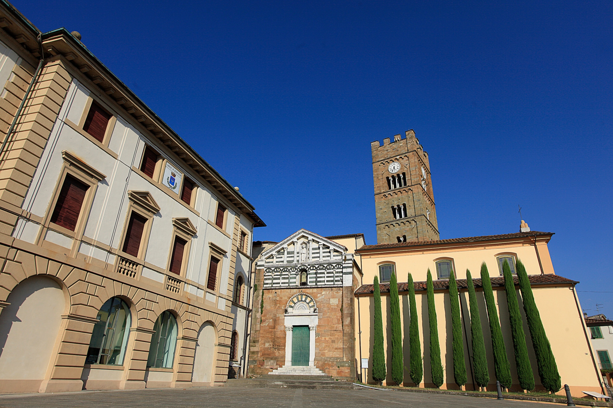
From San Miniato an extraordinarily beautiful trail follows along the hilly ridges of Val d'Elsa, scattered with castles, fortresses, lodges and abbey complexes, reaching the parish church of Coiano with its steep stone staircase, and the parish church of Santa Maria in Chianni, rebuilt in the 12th century. Shortly afterwards, you reach Gambassi Terme which takes its name from its beneficial waters.
From San Miniato an extraordinarily beautiful trail follows along the hilly ridges of Val d'Elsa, scattered with castles, fortresses, lodges and abbey complexes, reaching the parish church of Coiano with its steep stone staircase, and the parish church of Santa Maria in Chianni, rebuilt in the 12th century. Shortly afterwards, you reach Gambassi Terme which takes its name from its beneficial waters.
- straighten
Length23,7 km
-
DifficultyAverage
- schedule
Duration6 ore
- trending_down
Descent231 m
- trending_up
Ascent406 m
- vertical_align_top
Maximum altitude305 m
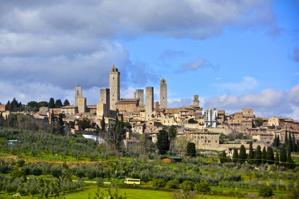
Departing from Gambassi Terme there is a short route along the beautiful ridges of Val d'Elsa, scattered with castles, historic parish churches and abbeys, before reaching the Pancole sanctuary, leading back to the village of Collemuccioli with a stretch of medieval pavement, and from here to the parish church of Cellole, then going up towards the hill where the towers of San Gimignano rise. To see: the frescoes of the municipal palace.
Departing from Gambassi Terme there is a short route along the beautiful ridges of Val d'Elsa, scattered with castles, historic parish churches and abbeys, before reaching the Pancole sanctuary, leading back to the village of Collemuccioli with a stretch of medieval pavement, and from here to the parish church of Cellole, then going up towards the hill where the towers of San Gimignano rise. To see: the frescoes of the municipal palace.
- straighten
Length13,3 km
-
DifficultyEasy
- schedule
Duration3 ore
- trending_down
Descent329 m
- trending_up
Ascent344 m
- vertical_align_top
Maximum altitude388 m
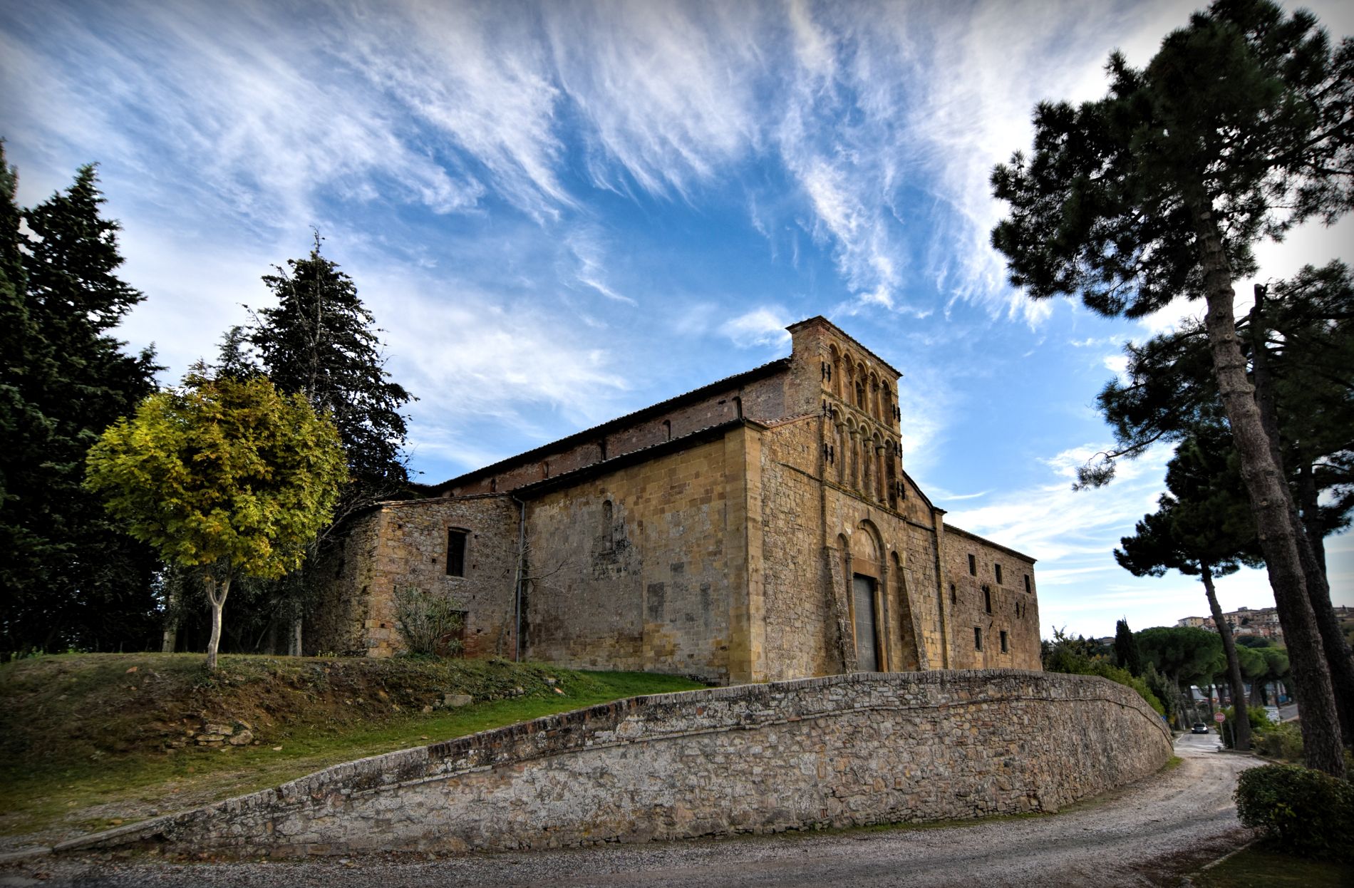
From San Gimignano, through dirt roads and up and down paths, we enter the valley of the Foci stream, finding a ford near Molino d'Aiano, one of Sigeric's precisely identified places. Continuing on, one intercepts the splendid fortified village of Colle Val d'Elsa, lapped by the turquoise waters of the Elsa river. Finally we reach the complex of Abbadia a Isola, before seeing Monteriggioni, with its walls and unmistakable crown of towers dominating the hillside.
It is possible to take an alternative route, leaving the main one in the vicinity of Molino d'Aiano. It then continues by intercepting the picturesque Badia a Coneo, passing through the towns of Gracciano and Quartaia, and then rejoining the main route near Le Caldane, where thermal springs known since Roman-Etruscan times flow. Download the track of the alternative route (kml).
- straighten
Length31 km
-
DifficultyDemanding
- schedule
Duration7.30 h
- trending_down
Descent563 m
- trending_up
Ascent513 m
- vertical_align_top
Maximum altitude320 m
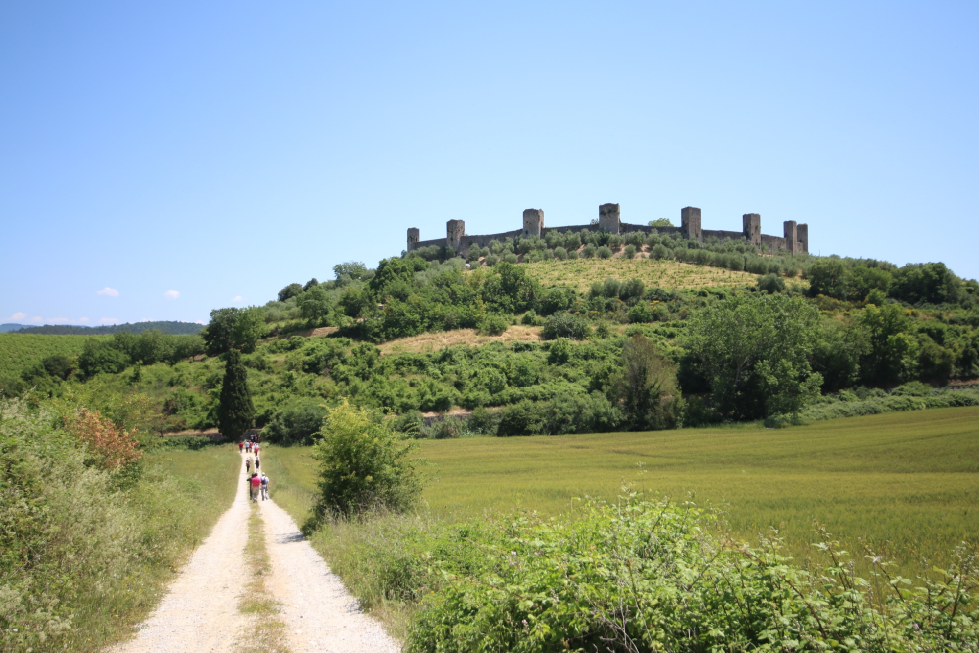
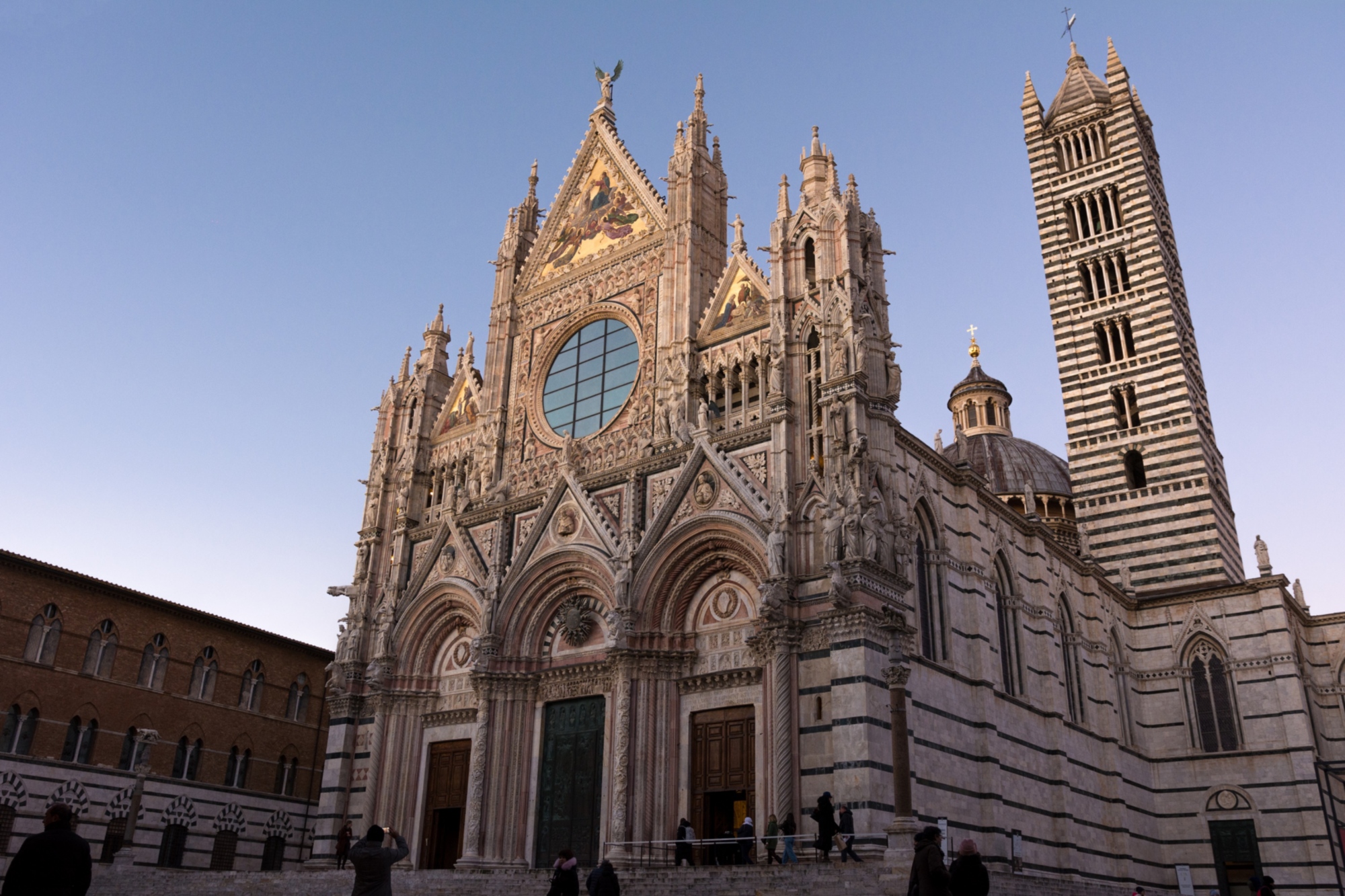
From Monteriggioni, we walk along the dirt roads of the Sienese mountainous area towards the medieval village of Cerbaia. After passing the castles of Chiocciola and Villa, following the ups and downs, you reach Siena from Gate Camollia. The city will surprise you with the beauty of its Piazza del Campo, the Duomo and the hospital of Santa Maria della Scala, one of the most important museum centers in Siena.
From Monteriggioni, we walk along the dirt roads of the Sienese mountainous area towards the medieval village of Cerbaia. After passing the castles of Chiocciola and Villa, following the ups and downs, you reach Siena from Gate Camollia. The city will surprise you with the beauty of its Piazza del Campo, the Duomo and the hospital of Santa Maria della Scala, one of the most important museum centers in Siena.
- straighten
Length20,6 km
-
DifficultyAverage
- schedule
Duration4.30 ore
- trending_down
Descent282 m
- trending_up
Ascent330 m
- vertical_align_top
Maximum altitude354 m
From Siena there is a challenging route along the dirt roads of the Val d'Arbia where you reach the Grancia di Cuna, a centuries-old fortified farm owned by the hospital of Santa Maria della Scala. Continuing along the offshoots of the Crete Senesi, and passing Monteroni, you reach the fortified village of Lucignano d'Arbia up to Ponte d'Arbia.
From Siena there is a challenging route along the dirt roads of the Val d'Arbia where you reach the Grancia di Cuna, a centuries-old fortified farm owned by the hospital of Santa Maria della Scala. Continuing along the offshoots of the Crete Senesi, and passing Monteroni, you reach the fortified village of Lucignano d'Arbia up to Ponte d'Arbia.
- straighten
Length25,79 km
-
DifficultyAverage
- schedule
Duration6.20 ore
- trending_down
Descent408 m
- trending_up
Ascent234 m
- vertical_align_top
Maximum altitude318 m
From Ponte d'Arbia you reach the perfectly preserved village of Buonconvento. Going up the Ombrone valley, you travel along a stretch of the Cassia to Montalcino. Along dirt roads, you reach Torrenieri accompanied by the panoramas of the Val d'Orcia, finally arriving at San Quirico d'Orcia.
From Ponte d'Arbia you reach the perfectly preserved village of Buonconvento. Going up the Ombrone valley, you travel along a stretch of the Cassia to Montalcino. Along dirt roads, you reach Torrenieri accompanied by the panoramas of the Val d'Orcia, finally arriving at San Quirico d'Orcia.
- straighten
Length26,25 km
-
DifficultyDemanding
- trending_down
Descent258 m
- trending_up
Ascent513 m
- vertical_align_top
Maximum altitude399 m
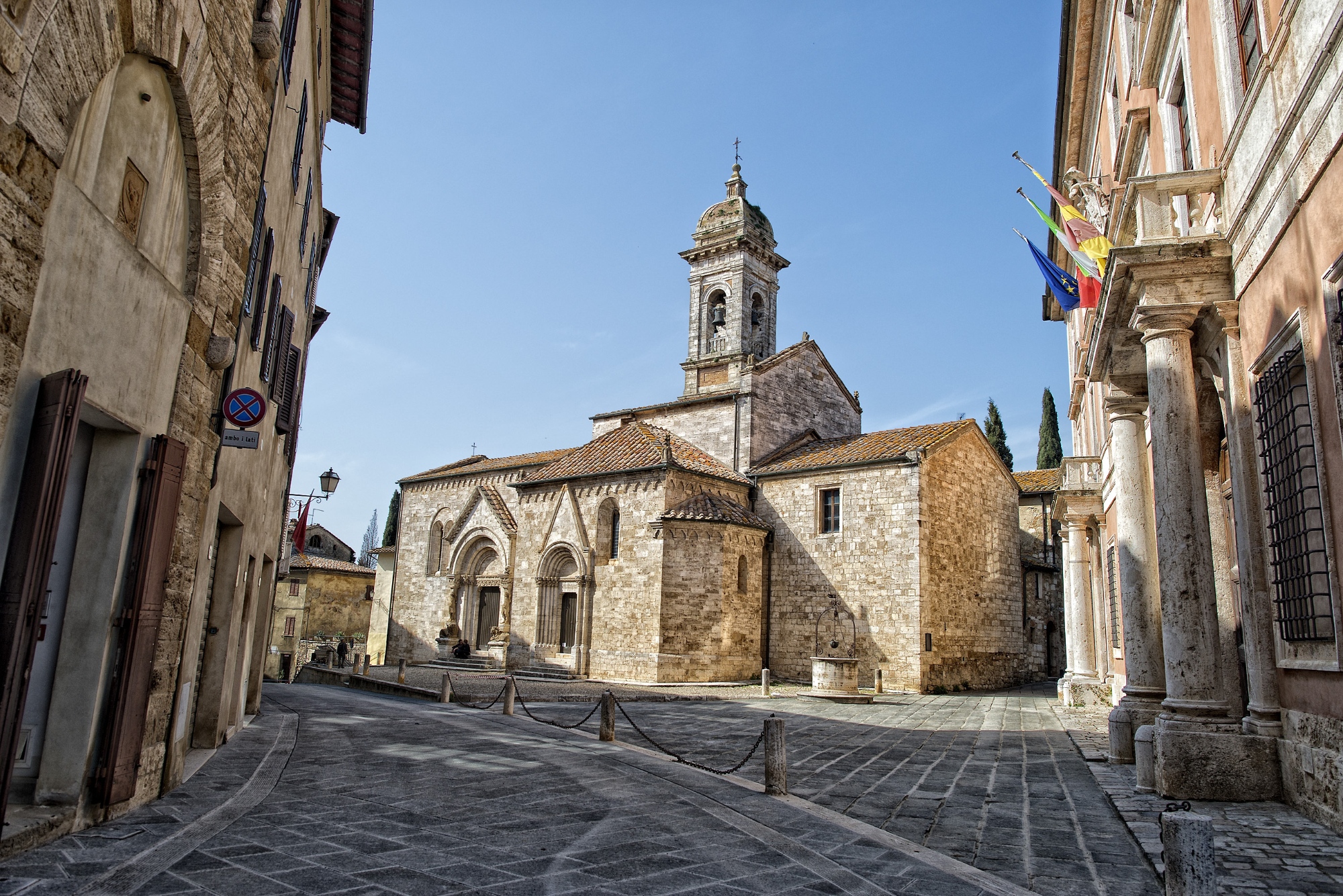
From San Quirico d’Orcia, through the bare hills, you come to the little fortified town of Vignoni, with its views of Val d’Orcia, and then descend to Bagno Vignoni, which is famous for its vast thermal pool. It is worth stepping off the beaten track to have a look at the historic center of Castiglione d’Orcia and the tower of the Tentennano Fortress. A long undulating stretch through the valleys of the Orcia and Paglia rivers take you to the old guest house of Le Briccole, and eventually to Radicofani.
It is also possible to take a nice variant route that meets the village of Abbadia San Salvatore. Download the route of the Abbadia San Salvatore variant (kml).
- straighten
Length33,02 km
-
DifficultyVery demanding
- schedule
Duration7.15 ore
- trending_down
Descent532 m
- trending_up
Ascent908 m
- vertical_align_top
Maximum altitude790 m
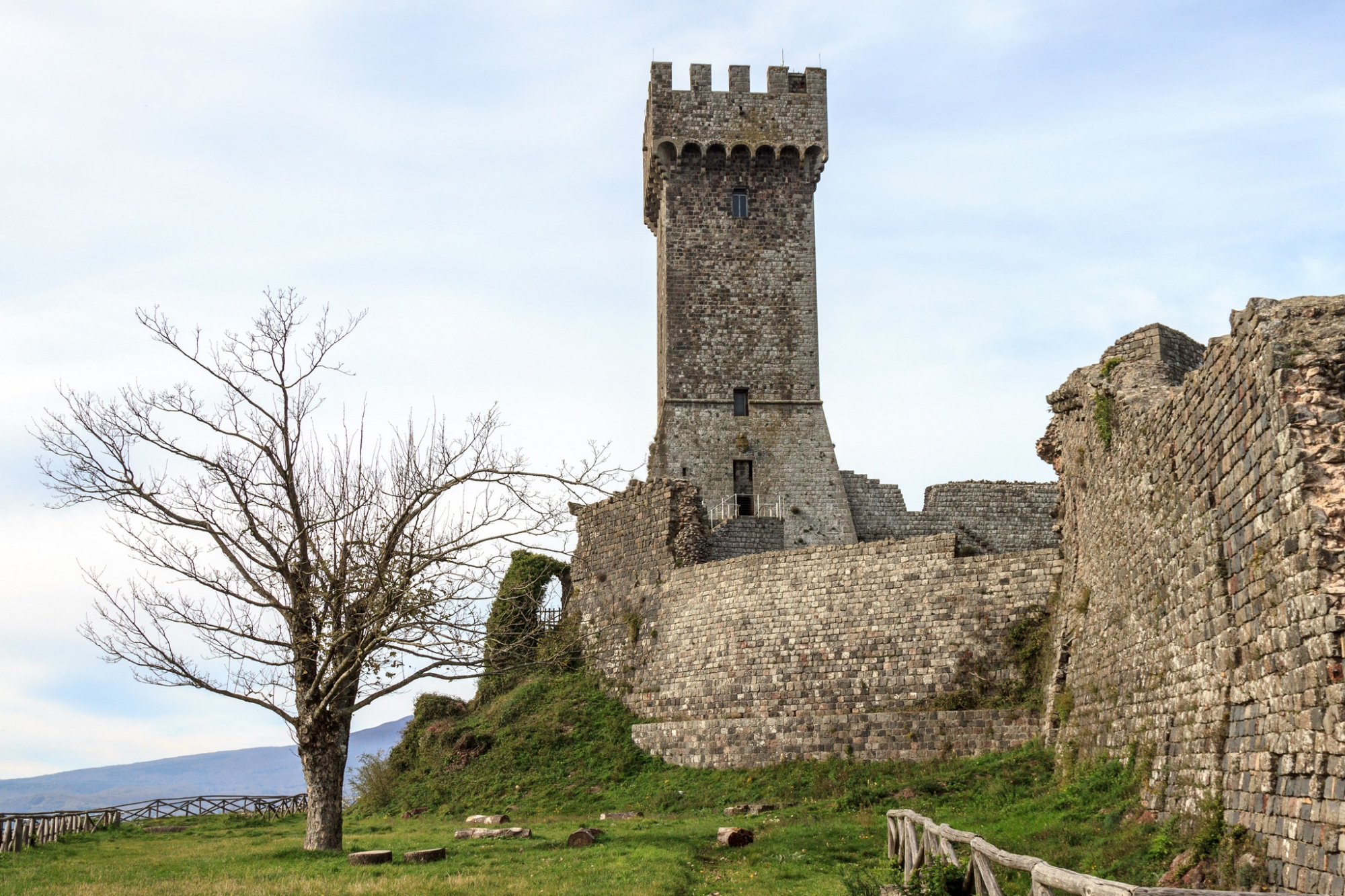
From Radicofani - whose Fortress is admired - descending along the ridge, with a far-reaching view towards the hills, of Val d’Orcia and of Mount Amiata, the Via Francigena comes to Ponte a Rigo, enters Lazio and then along a dirt track with views of the Paglia valley it reaches Proceno up to Acquapendente.
Visit the official website: ViaFrancigenaToscana.it
- straighten
Length24 km
-
DifficultyDemanding
- schedule
Duration7 ore
- trending_down
Descent400 m
- trending_up
Ascent220 m
- vertical_align_top
Maximum altitude780 m