Skip to content
Default
Photo © Shutterstock / Claudiovidri

3 routes to reach the Acquacheta Waterfall

Panoramic trekking itineraries in the Casentino Forests National Park discovering the famous waterfall mentioned by Dante

Among the most interesting hiking trails that can be undertaken in the territory of the National Park of the Casentinesi Forests, Monte Falterona and Campigna are those that reach the scenic Acquacheta Waterfall. The wild corner of earthly paradise is nestled among the majestic Casentino forests, made famous by the verses of Dante Alighieri's Divine Comedy in which his journey from Florence to Ravenna is recounted, passing through the Acquacheta.

The natural spectacle is described by the Supreme poet:

As that river, that springs
first from Monte Veso to the east
on the left slope of the Apennine
and is called Acquacheta above, before
it sinks valleyward into its low bed
and at Forli no longer has that name

reverberates there near San Benedetto
falling from the Alpe with a single leap
fed perhaps by a thousand torrents
Dante, Inferno, XVI, 94-105

In this article, we recommend 3 routes to reach this pristine eden on the border between Tuscany and Emilia Romagna.

Contents
  • 1.
    The classic ring route
  • 2.
    The alternative itinerary
  • 3.
    For the fittest
1.

The classic ring route

path in the woods
Towards the Acquacheta - Credit: Davide Alberani

Estimated travel time (excluding stops): 4 hours
Length: approx. 11 km
Altitude difference uphill: approx. 500 mt

The usual excursion itinerary undertaken to reach the spectacular Acquacheta waterfalls (very popular on summer Sundays) runs in a ring route that departs and arrives from the charming village of San Benedetto in Alpe (in Emilia Romagna) that can be reachedby driving from San Godenzo through the Muraglione Pass. From the town, take path 407 which runs along the left bank of the Acquacheta river and intercepts the Romiti mill; the waterfall is almost the mid point of the ring which then bends over the Piana dei Romiti and Monte di Londa, before returning to San Benedetto in Alpe. The path requires no technical skills other than a little aptitude for walking.

1.

The alternative itinerary

The Acquacheta River
The Acquacheta River - Credit: Shutterstock / MaurizioR75

Estimated travel time (excluding stops): 4 hours
Length: approx. 14 km
Difference in height uphill one way: approx. 750 mt

Immerse yourself in nature with this compelling itinerary that's an alternative to the popular one that starts from San Benedetto in Alpe. The path starts and ends near the Passo della Peschiera and crosses Mount Lavane, a place linked to the tragic events of the Second World War that's part of the Gothic Line. After passing the charming fields of Pian Baruzzoli, you reach the Acquacheta waterfall. The most interesting part of the itinerary is the climb from the waterfall to the top of Mount Lavane, following the CAI path 413 and encountering Briganzone and the panoramic and steep Balze di Cornacchiaia, which needs to be undertaken with caution in the event of adverse weather conditions or the presence of snow and ice.

This beautiful excursion requires the proper equipment. It does not present any particular technical difficulties but requires a little physical effort due to the length and the uphill gradients.

1.

For the fittest

rock protruding from the valley
Above the Acquacheta - Credit: Davide Alberani

Estimated travel time outward (excluding stops): 4 hours
Outward length: approx. 13 km
Difference in height uphill one way: approx. 1300 mt

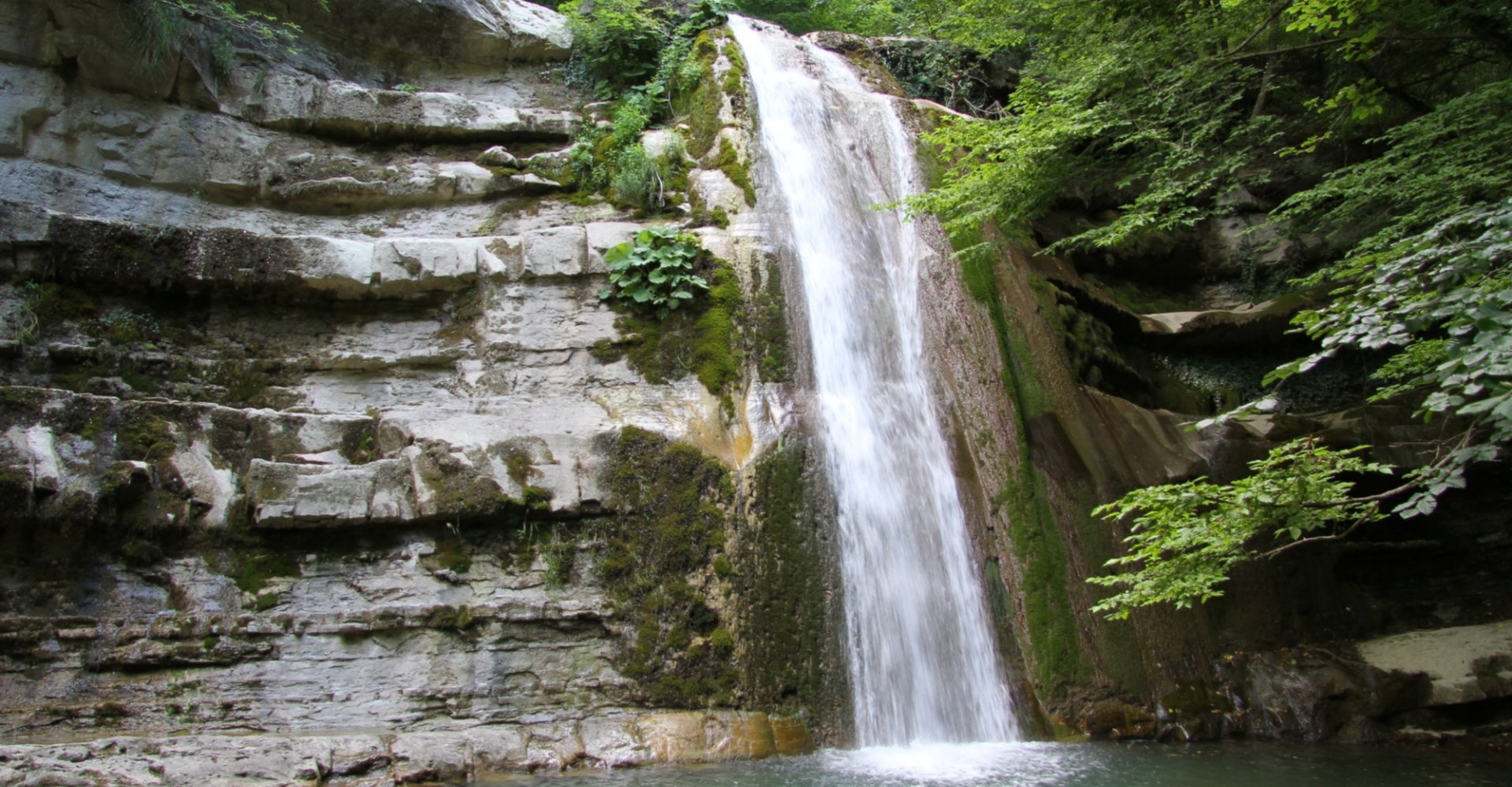
Those who are well-trained and want to take on a more challenging trek can reach Campigno, a small village in Marradi on the Tuscan side, which is the starting point of this beautiful itinerary that consists of a round trip with many scenic opportunities. Leaving the town, take the small road that leads to Farfareta, and then take the CAI path 533 leading to the ridge. Among green meadows, broad-leaved woods, beautiful landscapes and some climbs, you reach an altitude of 1200 near Pian Porcello where the Capanna del Partigiano shelter is located for a few moments of refreshment. Another climb brings you to conquer the summit of Mount Lavane. Then, leave the ridge and head towards the Acquacheta waterfall while surrounded by forest and take a mule track to reach San Benedetta in Alpe if you wish.

It's good to remember to add the kilometres and metres of altitude difference uphill of the outward journey and for the return journey, in order to evaluate the physical effort that the excursion entails, otherwise it's suggested to organize yourself with the cars at the starting point and arrival point of the itinerary.

The routes take place in natural environments along paths or dirt roads of inconsistent and uneven terrain, therefore we strongly recommend wearing trekking shoes with a sole with a good grip, and to check the weather conditions and the state of the paths by contacting the park before embarking on these beautiful treks to discover the Acquacheta and the woods and landscapes that surround it.

What’s nearby?

Must-see places, stage-by-stage routes, events and tips for your trip
Ideas • 51 results
Itineraries • 27 results
Travelogs • 1 results