

A spiritual itinerary on foot, from Mantua to Lucca
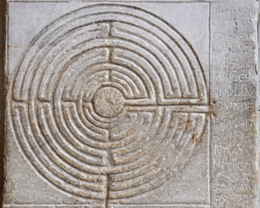
The Via Matildica and the Via del Volto Santo are two routes joined by a single destination: Lucca’s Duomo di San Martino, home to the wooden sculpture of the Volto Santo. Also known as the “black Christ of the Lucans”, the sculpture is the source of many a myth and legend. At Castelnuovo di Garfagnana, the two paths meet to become one.
The Via Matildica starts from Mantua, and encounters the plains of the Po and the elevations of the Appenine National Park on its way to Tuscany, which it reaches via the San Pellegrino Pass. It then passes through Garfagnana and the Mid Serchio Valley in order to arrive, finally, in Lucca.
The route twists and turns for 284 kilometres as it passes through three regions: Lombardy, Emilia-Romagna and Tuscany. Along the way it encounters several towns bursting with cultural richness, as well as gorgeous expanses of nature and dazzling scenery. It is historically divided into three different sections: the Way of the Most Precious Blood (from Mantua to Reggio Emilia, three stages); the San Pellegrino Way (from Reggio Emillia to San Pellegrino in Alpe, five stages) and the Via del Volto Santo (from Castelnuovo in Garfagnana to Lucca, three stages). In our itinerary we focus on describing the section of the route that crosses Tuscany, which starts from Gazzano, Reggio Emilia.

The Via Matildica connects the various sites linked to Matilda of Tuscany, the feudal potentate and vice-queen of Italy in the eleventh century. Born in Mantua, she was a great supporter of the papacy and had churches and guest houses built along the main stretches of the route.
The eighth stage of the Matildica starts at Gazzano and is the highest and most demanding stage of the entire route. It reaches the ridge of the Apennines to then arrive in San Pellegrino in Alpe, on the border between Emilia and Tuscany. In the case of difficult weather conditions or in cold seasons, it is possible to take the modified route described as stage 8b on the official site of the Via Matildica.
From Gazzano you carry on towards Civago and cut through the ruins of the old Amorotto Tower. After arriving at Case Civago, take the path which leads to Segheria Refuge, and from there the path 681 to Passo delle Forbici. You must then follow the forest path to reach the highest point of the whole of the Via Matildica del Volto Santo: the Passo del Giovarello (almost 1700 metres). The view is breathtaking!
From Giovarello the route leads you down to Piana della Maccherie and the fields of San Geminiano, until it reaches Passo delle Radici. From here the path goes down to the right, taking you through forests and meadows, and passes by the Pradaccio Refuge. After around a kilometre, you arrive at San Pellegrino in Alpe.
- straighten
Length22.4 km
- schedule
Duration8 h
- trending_down
Descent522 m
- trending_up
Ascent1099 m
A long descent leads us into the heart of the Garfagnana. Having passed San Pellegrino in Alpe, we continue as far as the small town of Valbona, and then by way of a narrow tarmac road to the centre of Castiglione di Garfagnana. It’s worth taking a short break to see the village: it is surrounded by a medieval perimeter wall which is still intact, and is characterised by intriguing alleyways.
After having crossed Castglione’s medieval bridge, you continue initially on a path, and then on a dirt road. Following the river, you reach Pieve Fosciana to then arrive at Castelnuvo di Garfagnana, the point of intersection with the Via del Volto Santo.
- straighten
Length19,3 km
- schedule
Duration6 h
- trending_down
Descent1610 m
- trending_up
Ascent377 m
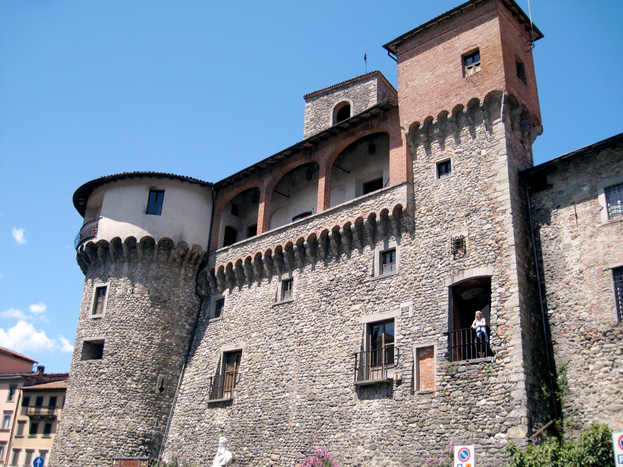
Admire the Fortress of Castelnuovo di Garfagnana, (the Rocca Ariotesca), which was the residence of the poet Ludovico Ariosto when he governed the Garfagnana. We leave Castelnuovo to climb along the Via Montealtissimo way as far as the small town of Palazzetto. Leading off from here is a path which will bring you to an entrance to the forest, and where you can enjoy a stunning view over the valley. You continue down a dirt track to the ruins of the Romanesque church of Santa Maria Maddalena and then carry on towards Cascio.
After passing through the village of Cascio, the next place we come across is Gallicano. From here we cross a long bridge over the Serchio Valley. By following the signs, you arrive at a road which appears to end in the forest, but which does in fact lead you to a point where you have to cross a country road. This should be done with care, before you begin the climb towards the town of San Bernardino. From there, down some long and narrow country roads, you reach your destination: Barga, the most populated town of the Mid Serchio Valley and a holder of the Bandiera Arancione for its excellence as a destination for tourism, hospitality and the environment. Nestled in the Apuan Alps, it is surrounded by beautiful countryside.
- straighten
Length15 km
- schedule
Duration5 h
- trending_down
Descent480 m
- trending_up
Ascent580 m
From the centre of Barga, the area around the Duomo, you head towards Porta Macchiaia. Take the aqueduct’s narrow path and at the Fornacetta Church take a right. The route climbs to the town of Buvicchia which offers a lovely view. After a section of tarmac road, a path appears on the right which leads rather steeply down to a little ford where you can cross the Loppora stream. From here, a dirt path through the woods will easily guide you to the centuries-old parish church of Loppia. You cross the ancient stone bridge which leads to Filecchio on the historic route of the “Solco”, where you will also find an old wash house. Continuing on, you reach the centre of Filecchio and head towards the village of Ponte All’Ania.
From Ponte All’Ania, on the right you will find the footpath which leads quickly but steeply to Piano di Coreglia, reaching the church of San Lorenzo. You then carry on in the direction of Ghivizzano Castle with its distinctive historic centre and the defence tower of Castruccio Castracani.
From Ghivizzano you take a few dirt paths and continue upwards, carefully crossing a bridge over the River Serchio. You then take a right and, in a hundred metres, cross the road following the signs for the dirt path which heads upwards to the right.
Here, you begin a climb which is demanding but on easy ground, and on a broad path. Awaiting you after you reach the top is a scenic descent to the town of Rocca. From here it is all downhill to Borgo a Mozzano, on a mix of tarmac and dirt trails.
- straighten
Length17.7 km
- schedule
Duration6 h
- trending_down
Descent793 m
- trending_up
Ascent514 m
You leave Borgo a Mozzano with its distinguishing Ponte della Maddalena, or “Devil’s Bridge”, and begin walking along a country road. You continue down the road for a few hundred metres, passing by the entrance to the Museum of the Gothic Line. You then turn to the right through an entrance in the retaining wall to then cross the road using an underpass.
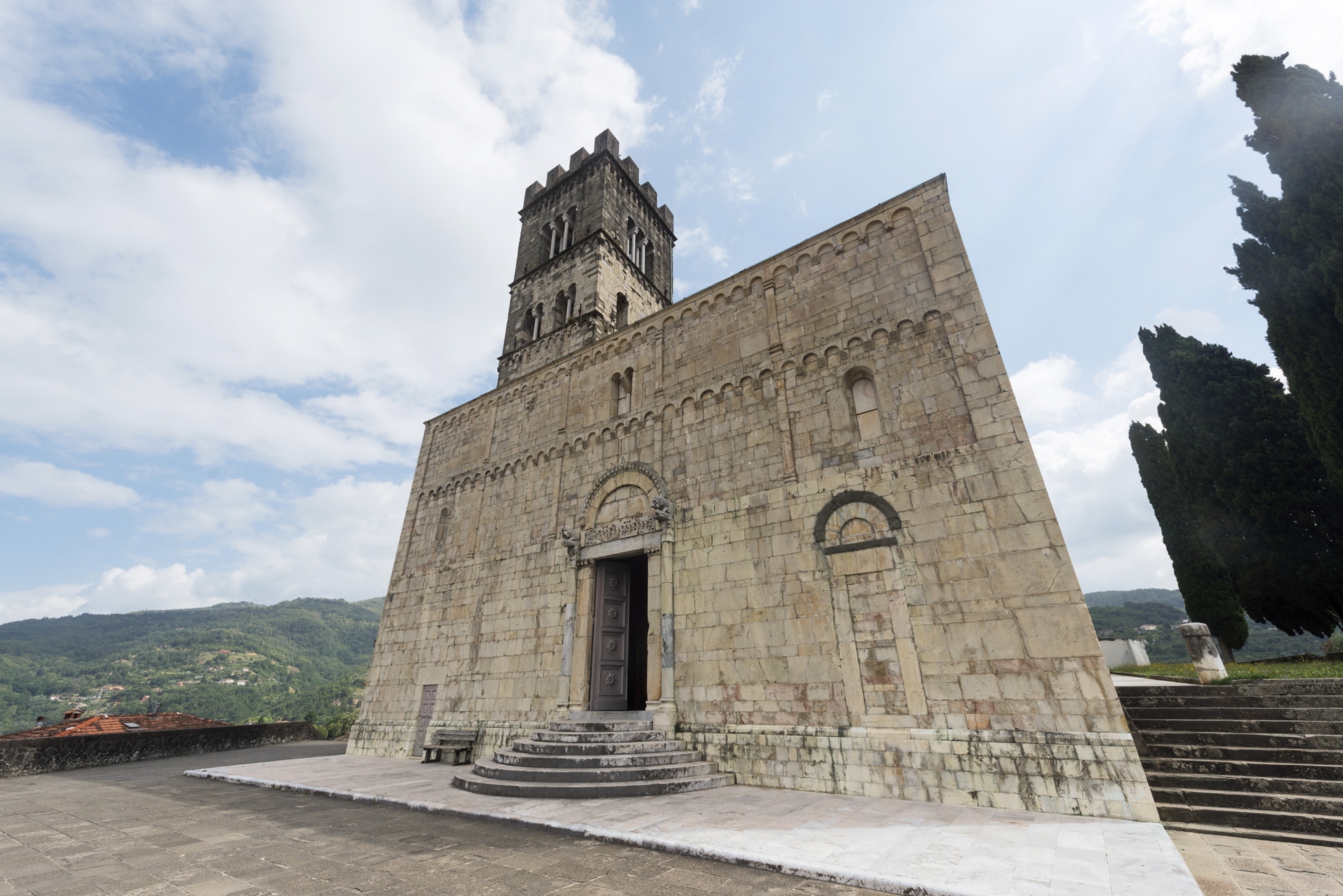
You now continue in a southwest direction to the town of Diecimo, where you will find the ancient parish church of Santa Maria, built by Matilde of Tuscany.
Carefully cross a road bridge and continue along the edge of the industrial area (the roadside is rather wide). Pay attention, as you only walk down here for three hundred metres before reaching the turning for Valdottavo.
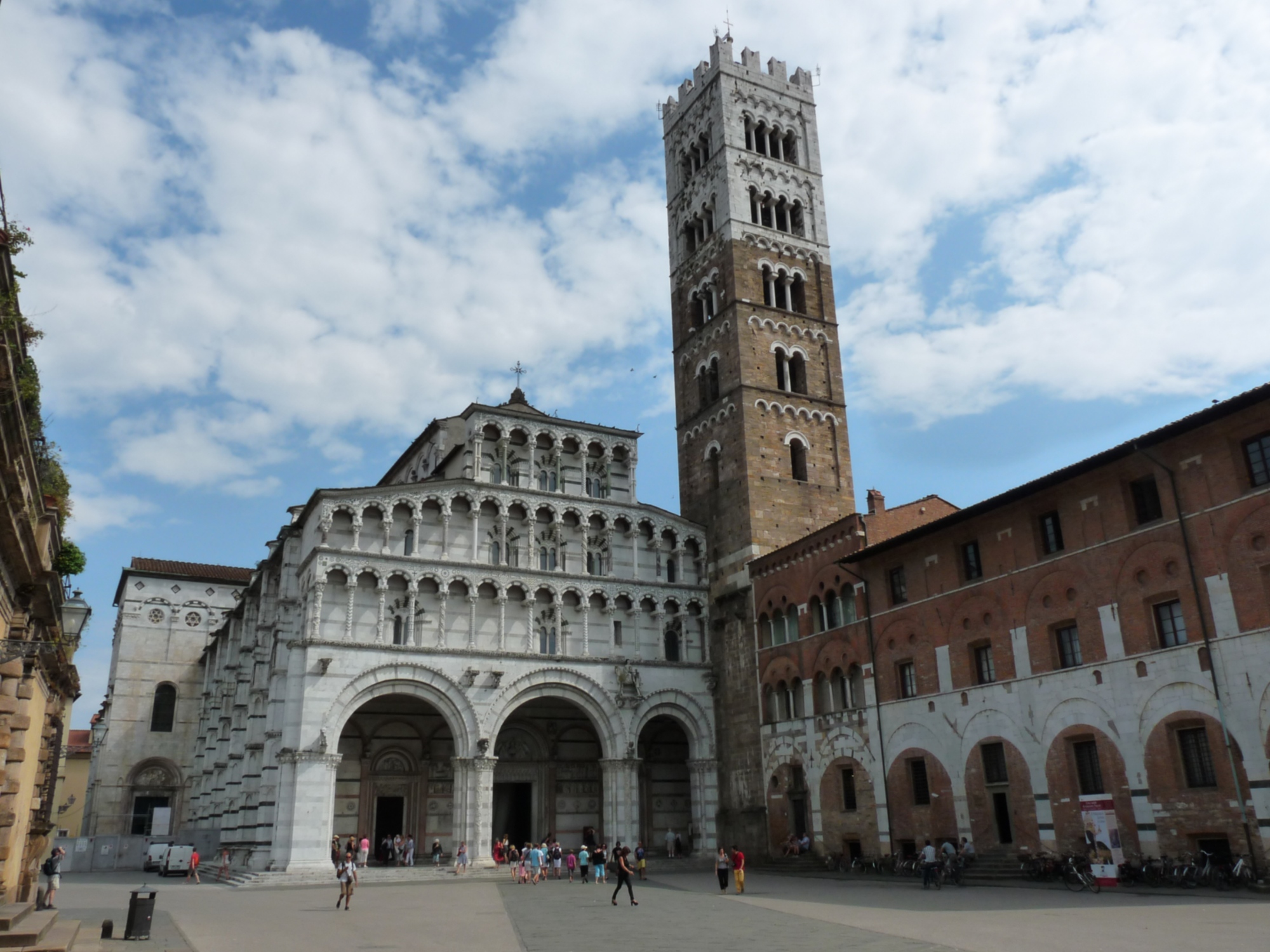
At the first houses of Valdottavo, the route climbs to arrive at San Donato and its little church. Heading in the direction of Ponte a Moriano, you cross the bridge over the Serchio and turning to the right, reach the opening of the foot- and cycle path which runs along beside the stream for around ten kilometres, almost as far as the point at which it flows underneath the walls of Lucca. You then reach the historic centre, passing by the Bastion of San Frediano to arrive at the Duomo, home of the sacred wooden statue, the long-awaited finish line of the Via Matildica.
Get the official credential: viamatildica.it/contatti/
You leave Borgo a Mozzano with its distinguishing Ponte della Maddalena, or “Devil’s Bridge”, and begin walking along a country road. You continue down the road for a few hundred metres, passing by the entrance to the Museum of the Gothic Line. You then turn to the right through an entrance in the retaining wall to then cross the road using an underpass.
You now continue in a southwest direction to the town of Diecimo, where you will find the ancient parish church of Santa Maria, built by Matilde of Tuscany.
Carefully cross a road bridge and continue along the edge of the industrial area (the roadside is rather wide). Pay attention, as you only walk down here for three hundred metres before reaching the turning for Valdottavo.
At the first houses of Valdottavo, the route climbs to arrive at San Donato and its little church. Heading in the direction of Ponte a Moriano, you cross the bridge over the Serchio and turning to the right, reach the opening of the foot- and cycle path which runs along beside the stream for around ten kilometres, almost as far as the point at which it flows underneath the walls of Lucca. You then reach the historic centre, passing by the Bastion of San Frediano to arrive at the Duomo, home of the sacred wooden statue, the long-awaited finish line of the Via Matildica.
Get the official credential: viamatildica.it/contatti/
- straighten
Length31 km
- schedule
Duration8 h
- trending_down
Descent478 m
- trending_up
Ascent393 m