

Walking from Siena to Cortona, in the footsteps of the old pilgrims
The Via Lauretana follows an Etruscan-Roman route that had great fortune even in medieval times. It connects the Sienese territory with the Valdichiana and therefore the Umbrian-Marche area. Later, it became more and more used as a pilgrimage route, connecting to Siena, and therefore the Via Francigena, through to Cortona, crossing Asciano, Rapolano Terme, Sinalunga, Torrita di Siena and Montepulciano. It then continued to Umbria, reaching the Holy House of Loreto in the Marche region from which it gets its name, Via Lauretana.
The Lauretana was a wonderful road, frequented by artists, merchants and pilgrims who have traveled it for centuries, transporting goods, conveying ideas, stopping in the various churches, chapels and Marian devotions that dot the entire route.
The Tuscan route is 114,3 km long and can be covered in 5 days, or in 4 days, for more experienced hikers.
In order to fully admire the breathtaking views and to appreciate the art and food and wine culture of all the areas you pass through, we advise you to travel in several stages and organize the journey over a number days to be able to better experience the route and get a true knowledge of authentic Tuscany!
From Siena you come to the hamlet of Arbia, where you take the provincial Lauretana (SP 438) and embark upon a first stretch of dirt track. In this stage, the Via Lauretana climbs to the peak of the biancane around Leonina, and then sticks to the crest on a clay, almost lunar-looking path. Pay attention: the clay underfoot in the rainy season is truly an experience that is not forgotten easily!
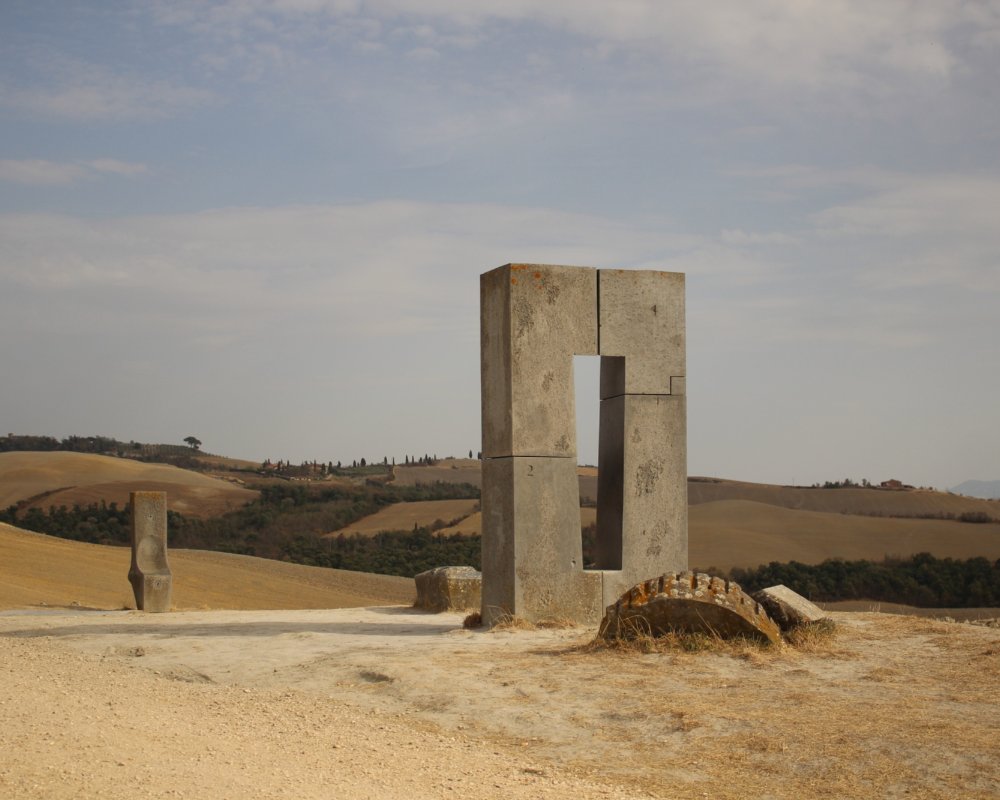
Keeping to the route, you arrive at a permanent stone installation by Jean Paul Philippe, a “Transitory Site” where passers-by can find a seat and a window angled to catch the last ray of sun on the summer solstice.
The route continues to Mucigliani, along a path that offers a 360-degree view of the Sienese countryside, right up to the start of the provincial road. Walk with care, heeding the signs that often instruct you to walk on the side of the asphalt road, and continue to the little settlement of Vescona, that was once an important castle.
More experienced walkers can continue and stop in Asciano, extending the first part of the route.
From Siena you come to the hamlet of Arbia, where you take the provincial Lauretana (SP 438) and embark upon a first stretch of dirt track. In this stage, the Via Lauretana climbs to the peak of the biancane around Leonina, and then sticks to the crest on a clay, almost lunar-looking path. Pay attention: the clay underfoot in the rainy season is truly an experience that is not forgotten easily!
Keeping to the route, you arrive at a permanent stone installation by Jean Paul Philippe, a “Transitory Site” where passers-by can find a seat and a window angled to catch the last ray of sun on the summer solstice.
The route continues to Mucigliani, along a path that offers a 360-degree view of the Sienese countryside, right up to the start of the provincial road. Walk with care, heeding the signs that often instruct you to walk on the side of the asphalt road, and continue to the little settlement of Vescona, that was once an important castle.
More experienced walkers can continue and stop in Asciano, extending the first part of the route.
- straighten
Length19,6 km
- trending_down
Descent395 m
- trending_up
Ascent430 m
- vertical_align_top
Maximum altitude365 m
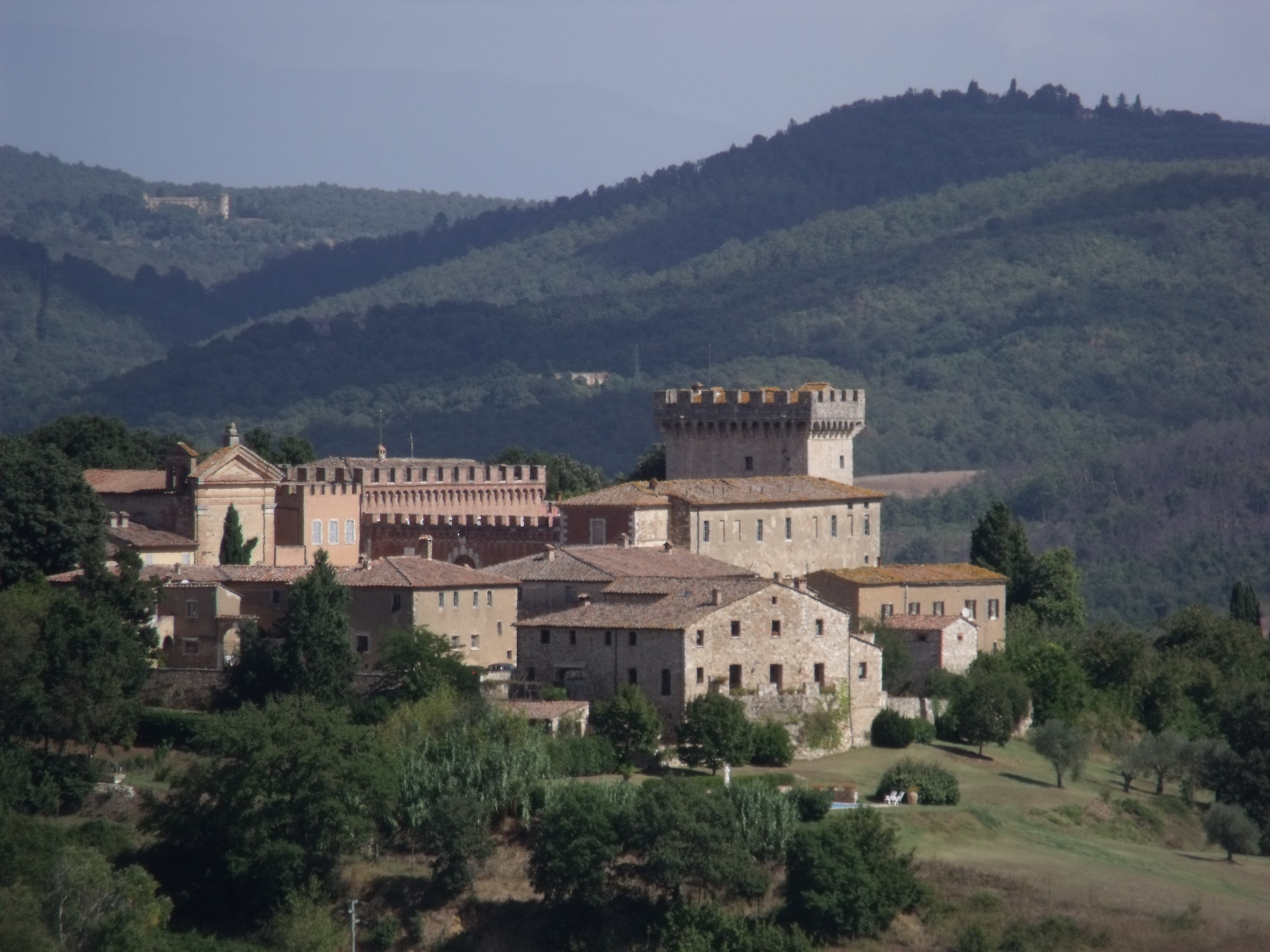
Leaving Vescona, follow the dirt road along which the famous bicycle races also passes, the L’Eroica and Strade Bianche (White Roads). Shortly after, we arrive at Monte Sante Marie, an important and strategic site for the control of the territory. Continuing on, you enter the village of Asciano, whose main road, Corso Matteotti as well as some side streets, still feature examples of devotional plaques, dedicated to the Madonna, functioning almost as signposts for pilgrims. Once out of the historic center, you arrive at the Parish church of Sant’Ippolito (the oldest church in the town of Asciano), which is private but can be visited by appointment. The route proceeds along field edges, eventually winding up in the hilltown of Serre di Rapolano.
Leaving Vescona, follow the dirt road along which the famous bicycle races also passes, the L’Eroica and Strade Bianche (White Roads). Shortly after, we arrive at Monte Sante Marie, an important and strategic site for the control of the territory. Continuing on, you enter the village of Asciano, whose main road, Corso Matteotti as well as some side streets, still feature examples of devotional plaques, dedicated to the Madonna, functioning almost as signposts for pilgrims. Once out of the historic center, you arrive at the Parish church of Sant’Ippolito (the oldest church in the town of Asciano), which is private but can be visited by appointment. The route proceeds along field edges, eventually winding up in the hilltown of Serre di Rapolano.
- straighten
Length23,1 km
- trending_down
Descent641 m
- trending_up
Ascent639 m
- vertical_align_top
Maximum altitude365 m
The Lauretana leaves Serre di Rapolano to reach the castle and estate of San Gimignanello, where you can stop for a visit and a bite to eat (booking necessary). The route then takes an old right of way easement among fields and woods, before emerging on an asphalt road that bears the Via Lauretana name: walk it for around 2.5 km (be aware that the asphalt road is often flanked by little pedestrian paths, to help you avoid the traffic). The route takes you through the old village of Scrofiano and into the main square of Sinalunga.
The Lauretana leaves Serre di Rapolano to reach the castle and estate of San Gimignanello, where you can stop for a visit and a bite to eat (booking necessary). The route then takes an old right of way easement among fields and woods, before emerging on an asphalt road that bears the Via Lauretana name: walk it for around 2.5 km (be aware that the asphalt road is often flanked by little pedestrian paths, to help you avoid the traffic). The route takes you through the old village of Scrofiano and into the main square of Sinalunga.
- straighten
Length19,3 km
- trending_down
Descent610 m
- trending_up
Ascent614 m
- vertical_align_top
Maximum altitude530 m
From the main square of Sinalunga, we head down to the historic Fonte del Castagno. We leave the asphalt for a country road that will take us to the Siena-Bettolle provincial road and from there, to the junction with the Siena-Perugia provincial road. We follow the country road for 300 meters in the direction of the historic Fratta estate, formed on what was once one of the most important roads of ancient Rome: the Cassia consular road. We continue the journey and take a stop in Torrita di Siena: a beautiful fortified village with walls that constituted a defensive bulwark for the Republic of Siena.
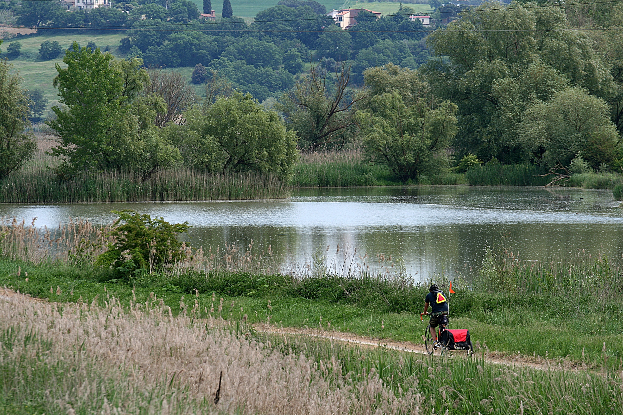
Leaving the village behind, the signs of the Via Lauretana take us towards the town of Abbadia and from there to the Montepulciano Scalo station. Once we reach Callone, we follow the cycle and pedestrian path of the Bonifica Route towards the north with our gaze turned towards our final stage. The village of Valiano was an old feudal castle which for centuries ensured safe passage for pilgrims who were heading towards Loreto.
From the main square of Sinalunga, we head down to the historic Fonte del Castagno. We leave the asphalt for a country road that will take us to the Siena-Bettolle provincial road and from there, to the junction with the Siena-Perugia provincial road. We follow the country road for 300 meters in the direction of the historic Fratta estate, formed on what was once one of the most important roads of ancient Rome: the Cassia consular road. We continue the journey and take a stop in Torrita di Siena: a beautiful fortified village with walls that constituted a defensive bulwark for the Republic of Siena.
Leaving the village behind, the signs of the Via Lauretana take us towards the town of Abbadia and from there to the Montepulciano Scalo station. Once we reach Callone, we follow the cycle and pedestrian path of the Bonifica Route towards the north with our gaze turned towards our final stage. The village of Valiano was an old feudal castle which for centuries ensured safe passage for pilgrims who were heading towards Loreto.
- straighten
Length28 km
- trending_down
Descent346 m
- trending_up
Ascent306 m
- vertical_align_top
Maximum altitude364 m
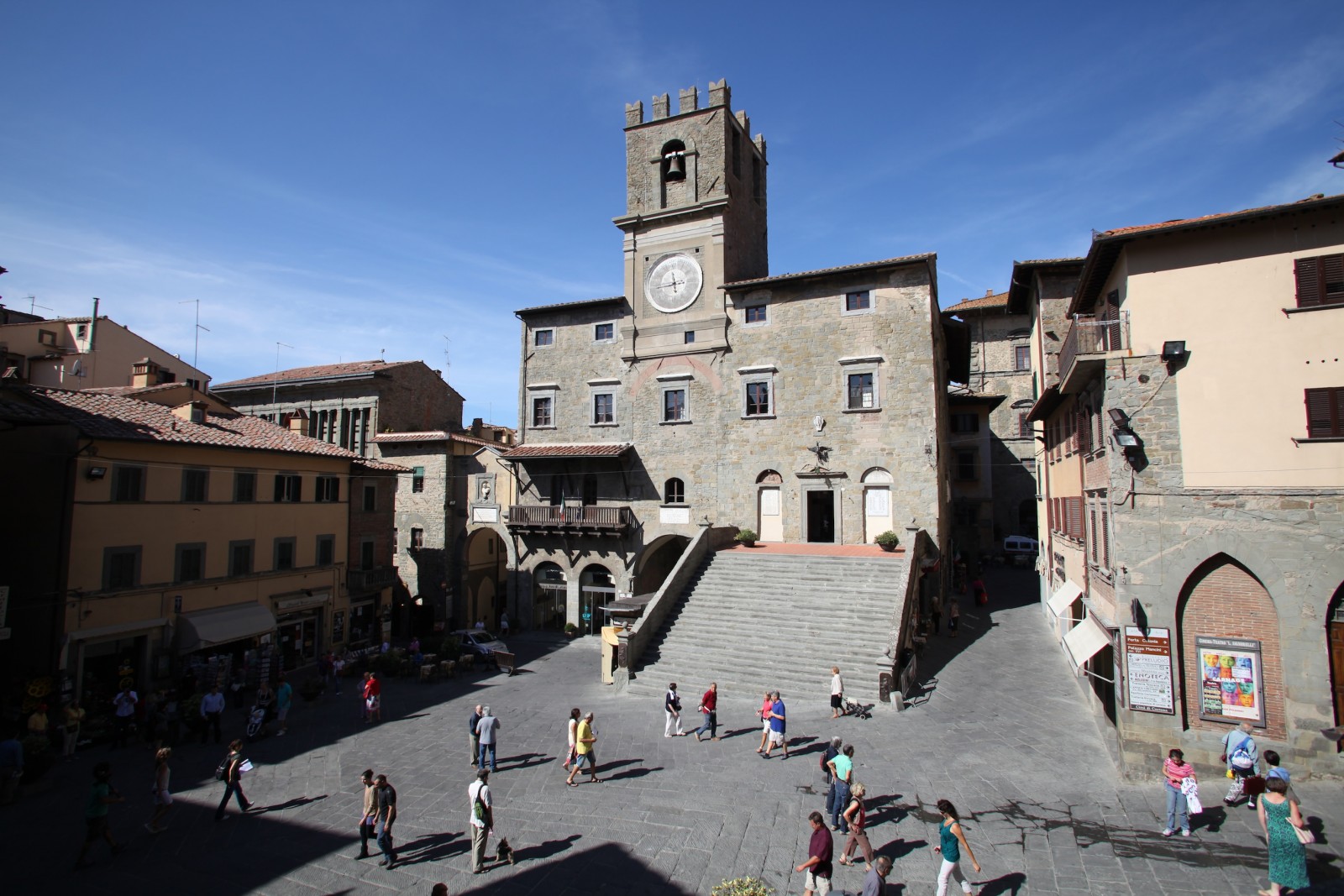
Once out of Valiano, take the asphalt road which gives way to gravel again after about 600m. Here, the Tuscan Lauretana jumps into Umbria for a brief stretch, but the landscape remains arable fields and vineyards until the overpass over the entry onto the Siena-Bettolle motorway. After the overpass, we continue towards Ossaia and then Montalla. The Via Lauretana then rises towards Cortona, frequently opening up to magnificent views over the Valdichiana, and arrives at Piazza Garibaldi, the entrance to the city’s historic centre.
Once out of Valiano, take the asphalt road which gives way to gravel again after about 600m. Here, the Tuscan Lauretana jumps into Umbria for a brief stretch, but the landscape remains arable fields and vineyards until the overpass over the entry onto the Siena-Bettolle motorway. After the overpass, we continue towards Ossaia and then Montalla. The Via Lauretana then rises towards Cortona, frequently opening up to magnificent views over the Valdichiana, and arrives at Piazza Garibaldi, the entrance to the city’s historic centre.
- straighten
Length24,5 km
- trending_down
Descent317 m
- trending_up
Ascent495 m
- vertical_align_top
Maximum altitude505 m
For details on the route, install the official Via Lauretana app (currently available for Android devices and Apple or download this file in pdf with the description of the stages or download this pdf file with a description of the various stages.