


Walking the path that connects Bologna with Florence
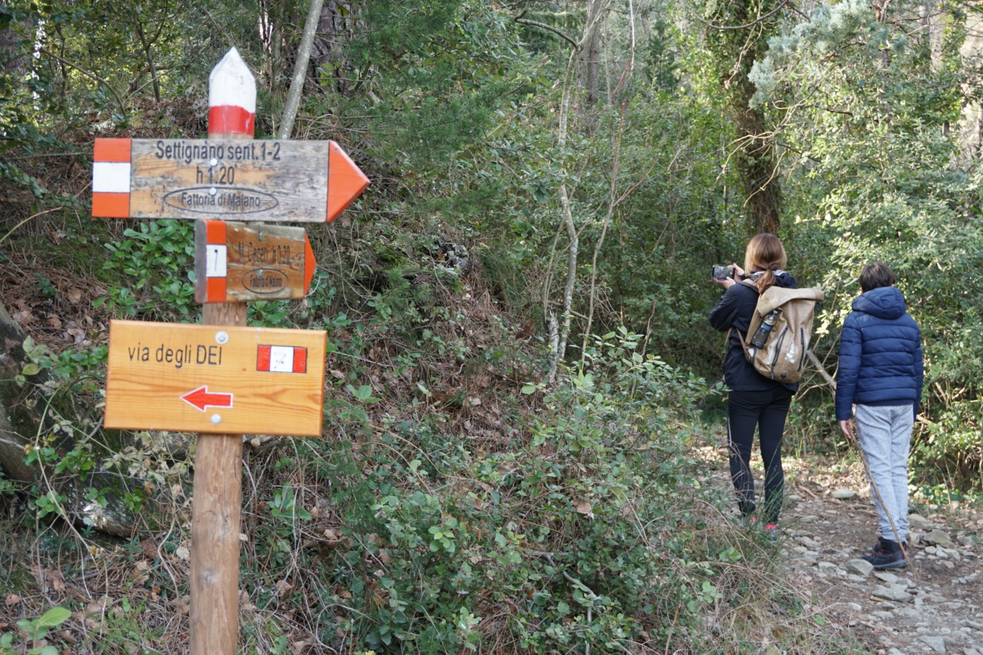
The Via degli Dei (Way of the Gods) follows an ancient road that was built by the Romans to connect the cities of Felsina (near Bologna) to Fiesole (near Florence). Known also as the Flaminian Way, the Path of the Gods is 130km of asphalt and dirt tracks across the Apennines, and can be either walked or cycled.
The name of the route probably derives from the names of the mountains that stand along it, like Monte Venere (Mount Venus), Monzuno (Mount Juno) and Monte Luario (which refers to the Moon Goddess).
A medium-difficulty route, it should take between four and six days on foot, depending on the fitness and training of the walkers, or two to three days by bicycle.
Whatever the means of transport, the route can be divided into 5 stages: the first from Bologna to Sasso Marconi – Badolo; the second from Badolo to Madonna dei Fornelli; the third from Madonna dei Fornelli to the Futa Pass – Monte di Fo’; the fourth from Monte di Fo’ to the pass of Osteria Bruciata – San Piero a Sieve; and the last and fifth from San Piero a Sieve to Fiesole – Florence.
Specifically, the Tuscan section of the Via degli Dei begins halfway along the route, somewhere on the third leg, between Madonna dei Fornelli and the Futa Pass.
The whole route is marked out by CAI (Club Alpino Italiano) signposting. You can find restaurants and hostels, B&Bs, campsites and much more along the way.
Length: 17.25 km
Ascent: 783 m
Descent: 753 m
Difficulty: Medium
From Madonna di Fornelli, heading towards Pian di Balestra and Piana degli Ossi, you find yourself walking on stretches of the ancient Roman Via Flaminia. The road leads into a coniferous wood, and, morphing into asphalt, it arrives at the Futa Pass. You have to keep to the same road until coming to a large parking area and the entrance to a German cemetery. At the Futa Pass roundabout, keep walking until you reach the sign that says “Santa Lucia – Monte di Fò”. Take the path to the left for around 3km, and when you come to a junction, keep left for Monte di Fò, or head right for the village of Santa Lucia.
Length: 21.08
Ascent: 641 m
Descent: 1197 m
Difficulty: Medium
From whichever place you decided to stay at, take the road that climbs towards the “Apparita”. You continue along asphalt roads, before being directed into a wood by GEA (Grande Escursione Appenninica) signposting.
Carrying on, you come to a well-signposted junction: take the CAI path no. 00, which goes to Monte Gazzaro.
Having conquered the summit of Monte Gazzaro, marked by a cross, you can leave a thought or sentence in the notebook that hangs from the stone structure. From here, you walk down the ridge, taking care with the terrain, which in parts can prove very loose.
You come to the wide open space that is the Osteria Bruciata Pass. The signposting here is very clear: take the CAI path no.46 for Sant’Agata, and then, at following junction, head right in the direction of Sant’Agata – San Piero a Sieve, until you arrive at the destination.
Length: 33.20 km
Ascent: 1367 m
Descent: 1510 m
Difficulty: Medium
This leg starts from the historic centre of San Piero a Sieve and follows CAI Bo-Fi signposting. After a little while, you have the option of taking a little detour to see the Medici Fortress of San Martino, as well as the Castello del Trebbio, breathtaking views, and a tabernacle from 1664.
Following the CAI 17 Bo-Fi Bivigliano directions, you will pass olive groves, medieval hilltowns and the distinctive landscapes of the Mugello. Carry on until you come to the main road for Florence, whereupon you turn left for Tagliaferro, eventually coming to the Abbey of Buonsolazzo.
After a break at the monastery of Monte Senario, you come to Olmo. The CAI path no. 2 continues climbing towards Poggio Pratone, which affords a stunning panorama over Florence. From Poggio Pratone you descend to Monte Fanna on a dirt track, at which point the route becomes asphalt again. You traverse the hamlet of Borgunto, and soon find yourself in the piazzas of Fiesole.
Here you can take the bus bound for Florence’s Piazza San Marco, and disembark instead in Piazza della Signoria. Or stay on your feet and take the CAI path no. 7, which climbs to Monte Ceceri and then drops into Coverciano.
Info: viadeglidei.it (in Italian)