The trail of the mushroom by bike


The "Trail of the mushroom" is named after the precious mushroom that grows in the undergrowths of Garfagnana and begins by leaving the historic town center of Castelnuovo di Garfagnana, departing from Porta Miccia. We cross the ancient stone bridge built in 1324 by Castruccio Castracani to join Cellabarotti, now the Santa Lucia district, to the "new castle." From the Alfieri Theater, we continue in the direction of Piano Pieve, passing the variant to Regional Road 445 with the pedestrian overpass, which connects us to Pontardeto. From here, in a short time, we reach lake Pontecosi with the characteristic passage over the small medieval bridge – shaped like a donkey saddle - of Madonna del Ponte. We find ourselves on the trail indicated as Via del Volto Santo, which we will follow northbound along the Serchio river as far as Villetta. The crossing of the railway bridge, as high as 54 meters on the riverbed, is always a thrill. Once we reach Poggio, we follow for a short stretch the historic track of Via Vandelli, as far as the “ferriera” (iron foundry) where the climb towards Roccalberti begins, a small agricultural village of stone houses perched on dark volcanic rocks.
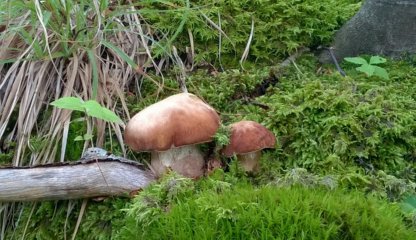
We leave Roccalberti for the small village of Vitoio, where the church of Santa Maria Assunta surely deserves a visit. WE move ahead towards Casatico, where the dirt road leading to Roggio begins, known as the “trail of the mushroom” for the delicious porcini mushrooms that are picked here, in the right seasons, in the extensive chestnut groves surrounding us.
The village of Roggio, at 800 meters above sea level, is dominated by the bell tower and the church of San Bartolomeo, built on the remains of an ancient fortress. After a well-deserved break, we tackle the last dirt road of the day with the climb to Casa Tontorone, exceptional vantage point on mount Pisanino, the highest peak of the Apuan chain. From here we reach Campocatino, the ancient pasture of sheperds where the small-sized stone houses, built on the edges of the glacial meadow basin, almost blend with the gray of the Roccandagia, one of the most beautiful mountains of the Apuan Alps.
From the alpine pasture we go back to the Giovetto crossing, descending now in the direction of Vagli Sotto and, skirting the lake, famous in the world because it hides with its waters the submerged village of Fabbriche di Careggine, we continue as far as Poggio, where we take the Regional Road 445 in the direction of Castelnuovo di Garfagnana. This is a stretch that we need to tackle carefully as traffic is heavier.
Tis itinerary is made up of two loops that intersect in the village of Poggio, where we’ll also find the railway station (Poggio-Careggine-Vagli) and from where we can leve to shorten the path by 15 kilometers.