


Exploring the historic landscapes among the carved out valleys of the Farma, Merse and Ombrone rivers
This itinerary passes through some of the most renowned regional nature reserves in Tuscany, where the Farma, Merse and Ombrone rivers have shaped the region.
As you walk along the 100km ring route between the Terre di Siena and the Maremma, you might come across a timeless environment, such as the low-lying beech forests of the Farma Regional Nature Reserve, or reach the rocky spur of the La Pietra Regional Nature Reserve, where many rare plant species can be found.
Along the journey there are also opportunities to observe the birds typical of fluvial environment, including the dipper (Cinclus cinclus) and the kingfisher (Alcedo atthis), wetland-bound amphibians such as the spectacled salamander (Salamandrina perspicillata), while some might be lucky enough to spot the mysterious wild cat (Felis silvestris).
An itinerary that can also be explored by mountain bike, while bearing in mind that the route by bike doesn’t always coincide with the route on foot.
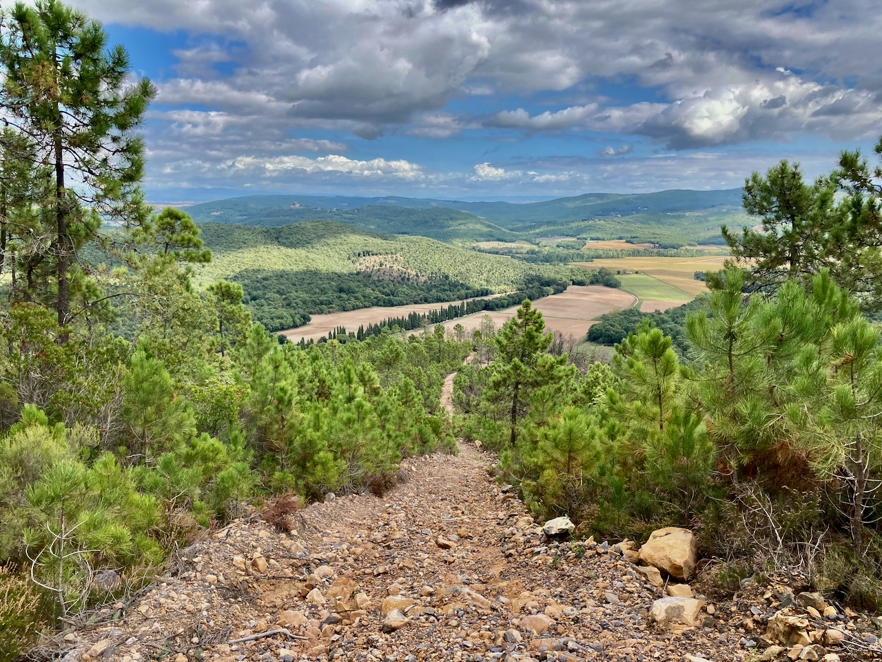
We leave the village of Torniella and continue on towards Bagni di Petriolo, crossing the Farma Regional Nature Reserve and the Belagaio State Reserve located within it. It's a fairly easy route through forests and pastures, mainly on paths and cart roads.
The Farma Regional Nature Reserve comprises one of the most untouched and scenically significant areas of the Farma Valley with its waterfalls, pools and potholes. As you go down towards Farma, you’ll pass from areas with Mediterranean vegetation (e.g holm oaks, cork oaks and strawberry trees) to areas with typical mountain species such as beech trees. Amphibians of conservation interest include the spectacled salamander (Salamandrina perspicillata) and the colourful Apuan mountain newt (Ichthyosaura alpestris apuana). Many species of birds, mammals and reptiles also find ideal habitats in the Reserve, including the Hermann’s tortoise (Testudo hermanni) and the cervone (Elaphe quatuorlineata). There are also rare and protected species of insects such as the flying deer (Lucanus cervus), the ivy moth (Euplagia quadripunctaria) and the ghost dragon dragonfly (Boyeria irene).
- straighten
Length23 km
-
DifficultyTrail for Experienced Hikers
- schedule
Duration6.5 hours
- trending_down
Descent973 m
- trending_up
Ascent715 m
From Bagni di Petriolo we take the provincial road with low traffic and enter the steep path indicated by the wooden panel engraved “Strada della Pia”. We then cross the Basso Merse Regional Nature Reserve until we reach San Lorenzo a Merse.
The Basso Merse Regional Nature Reserve includes the last stretch of the Farma, the final stretch of the Merse river and the confluence of the latter with the Ombrone. The Reserve particularly protects the rich riparian and river vegetation of the Merse and its species, such as the rare mourning cloak butterfly (Nymphalis antiopa), for example, whose caterpillar feeds mainly on willow leaves. In the past, the Reserve was an area of choice for the otter (Lutra lutra), however it’s still possible to observe the polecat (Mustela putorius), another mustelid linked to the presence of watercourses along which it hunts amphibians.
The Reserve is home to various species of amphibians, notably the emerald toad (Bufotes viridis balearicus) and the spectacled salamander (Salamandrina perspicillata). The woodland areas are home to many birds such as the nightjar (Caprimulgus europaeus), the woodlark (Lullula arborea) and the red-backed shrike (Lanius collurio).
- straighten
Length16.5 km
-
DifficultyHiking Trail
- schedule
Duration5.5 hours
- trending_down
Descent584 m
- trending_up
Ascent618 m
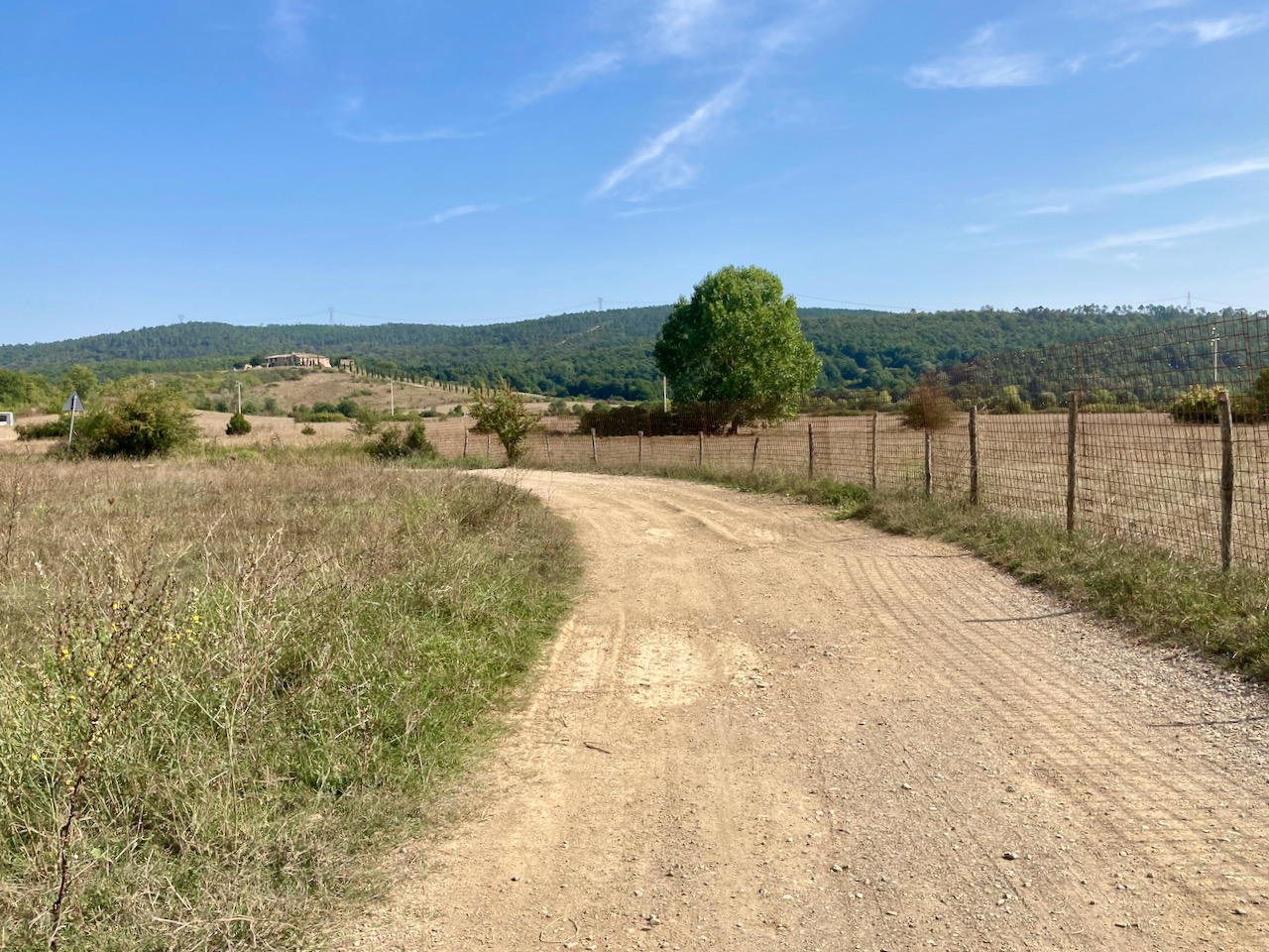
From San Lorenzo we reach the beautiful farmsteads of Cerreto a Merse and then continue north along the road that leads us to Pornella and then towards Brenna.
We are on the edge of the Alto Merse Regional Nature Reserve, which contains an impervious wooded area in a bend created by the Merse river. These forests provide an ideal environment for many birds and mammals, including the rare wild cat (Felis silvestris). In the Merse river there are still four species of fish native to the Tuscan-Lazio district: the Etruscan goby (Padrogobius nigricans), the Etruscan chub (Squalius lucumonis), the Etruscan barbel (Barbus tyberinus) and the rockfish (Rutilus rubilio). In some streams you might find the crayfish (Austrapotamobius pallipes italicus), a species at high risk in the Farma-Merse lagoon.
As far as the herpetofauna is concerned, the spectacled Salamander (Salamandrina perspicillata) and the Apennine frog (Rana italica) are worth mentioning. In the open areas of the Reserve you can observe uncommon species of prey such as the hen harrier (Circus cyaneus) and the porbeagle (Falco columbarius).
- straighten
Length14.5 km
-
DifficultyHiking Trail
- schedule
Duration5 hours
- trending_down
Descent556 m
- trending_up
Ascent549 m
From the village of Brenna we follow the signs of the well-marked trail 400, which in the first stretch runs along the Alto Merse Regional Nature Reserve and after a few minutes reaches Podere Campalfi. We continue left, entering the Reserve as far as Pentolina and then towards Monticiano, climbing up the Cerbaie hill, where the route meets a forest road that takes us onto the village of Monticiano. We are just a few kilometres away from the Abbey of San Galgano and the mysterious sword in the stone.
From the village of Brenna we follow the signs of the well-marked trail 400, which in the first stretch runs along the Alto Merse Regional Nature Reserve and after a few minutes reaches Podere Campalfi. We continue left, entering the Reserve as far as Pentolina and then towards Monticiano, climbing up the Cerbaie hill, where the route meets a forest road that takes us onto the village of Monticiano. We are just a few kilometres away from the Abbey of San Galgano and the mysterious sword in the stone.
- straighten
Length22.5 km
-
DifficultyTrail for Experienced Hikers
- schedule
Duration7 hours
- trending_down
Descent603 m
- trending_up
Ascent773 m
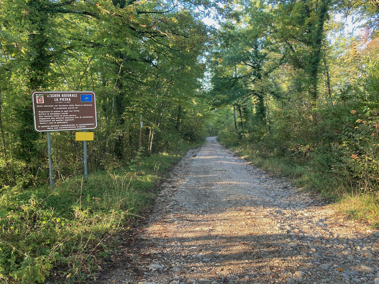
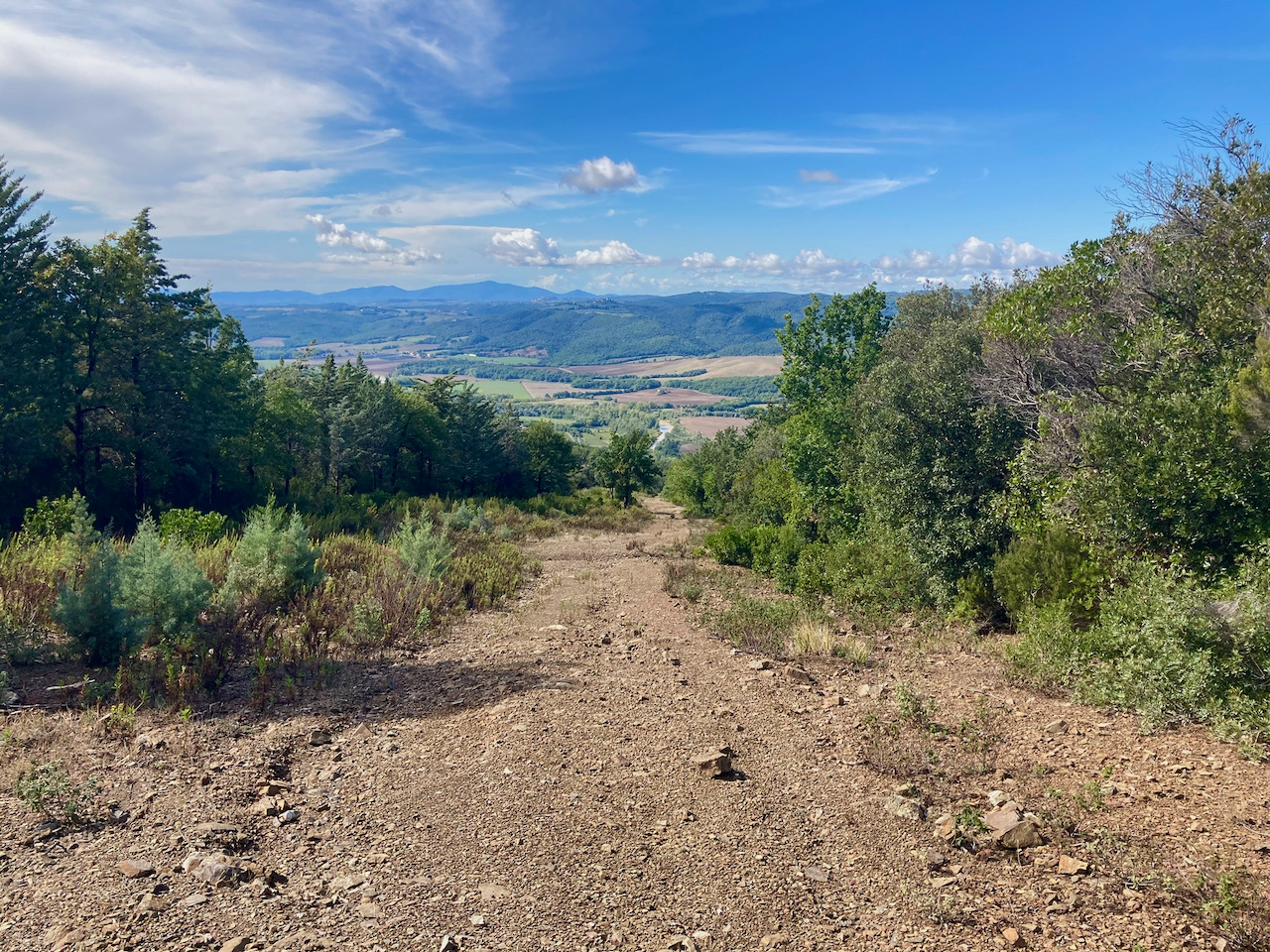
From Monticiano we walk through oak woods and fields, reach the ford of the Torrente Seggi and then continue on to the fork that will take us into the La Pietra Regional Nature Reserve, a dense woodland enclosed between the Farma and the Farmulla tributaries. The reserve takes its name from its most characteristic place: the Rupe di La Pietra, a large rocky spur from which you can dominate the course of the Farma and the reserve in general. Among the most interesting species of the cliff are the rare Greek lupine (Lupinus albus subsp.graecus), a leguminous plant with purple flowers, and the rare northern asplenium (Asplenium septentrionale), a fern with threadlike leaves.
There are numerous mammals and birds that frequent the Reserve: among the most popular species, the dipper (Cinclus cinclus) is worth mentioning, a species that can be observed along the watercourses and that dives in search of insect larvae.
We descend towards the valley until we reach the ford on the Farma stream. Once past the ford, we climb up the forest road past Podere La Pieve and then along the dirt road to Torniella, where we close our loop.
- straighten
Length20 km
-
DifficultyHiking Trail
- schedule
Duration6 hours
- trending_down
Descent680 m
- trending_up
Ascent740 m
The journey through the land of river continues at the Il Bogatto Regional Nature Reserve, which can be reached by car. The Nature Reserve safeguards the area of the valley floor of the River Ombrone, in particular the confluence with the River Merse and the forest area of the “Montalcino” regional complex. Many mammals can be observed here, such as the marten (Martes martes), which uses its agility to catch squirrels and small birds in the trees. The low level of human disturbance favours the presence and nesting of numerous species of birds, such as the woodlark (Lullula arboea), which is present between the wood and the agricultural areas of the Ombrone valley floor.
The journey through the land of river continues at the Il Bogatto Regional Nature Reserve, which can be reached by car. The Nature Reserve safeguards the area of the valley floor of the River Ombrone, in particular the confluence with the River Merse and the forest area of the “Montalcino” regional complex. Many mammals can be observed here, such as the marten (Martes martes), which uses its agility to catch squirrels and small birds in the trees. The low level of human disturbance favours the presence and nesting of numerous species of birds, such as the woodlark (Lullula arboea), which is present between the wood and the agricultural areas of the Ombrone valley floor.
- straighten
Length10 km
-
DifficultyHiking Trail
- schedule
Duration3 hours
- trending_down
Descent500 m
- trending_up
Ascent500 m
For more information on the "Tuscan Nature Itinerary - Reserve routes in reserve", please refer to the page of the Regione Toscana (Tuscan Regional Council) where it's possible to find further information on the whole network of thematic itineraries that connect the regional nature reserves, as well as download information on the stages and trails of the itineraries that can also be travelled by MTB.