The ring of Mount Amiata - Gravel


From a distance, the volcanic origin of Mount Amiata is evident, standing out, wide and lonely on a territory with no other peaks that can hold a candle to it. An island, in short, rising between the Maremma and the Apennine ridge.
And what could be more beautiful than making the circumnavigation of an island, in order to see it from all its sides? So, we will set off on this excursion, without the need for a boat license or a sailboat, a gravel bike will be more than enough.
The route comes to nearly 180 km touching 4000 m of elevation gain, so it cannot be planned in a single day. You need therefore to plan at least three days, depending on the level of training (or batteries), plus, perhaps, an additional day for the climb to the summit (1738m asl), which is unavoidable if you want to say you have met the Mount.
The itinerary is based on the twin itinerary created for road bikes in which, where possible, dirt road variants have been included. There are several possibilities to break up the itinerary and much depends on the starting point. In this case, we start from Abbadia San Salvatore and can therefore recommend, as stage points, Santa Fiora and Seggiano, at compatible distances for a three-day split.
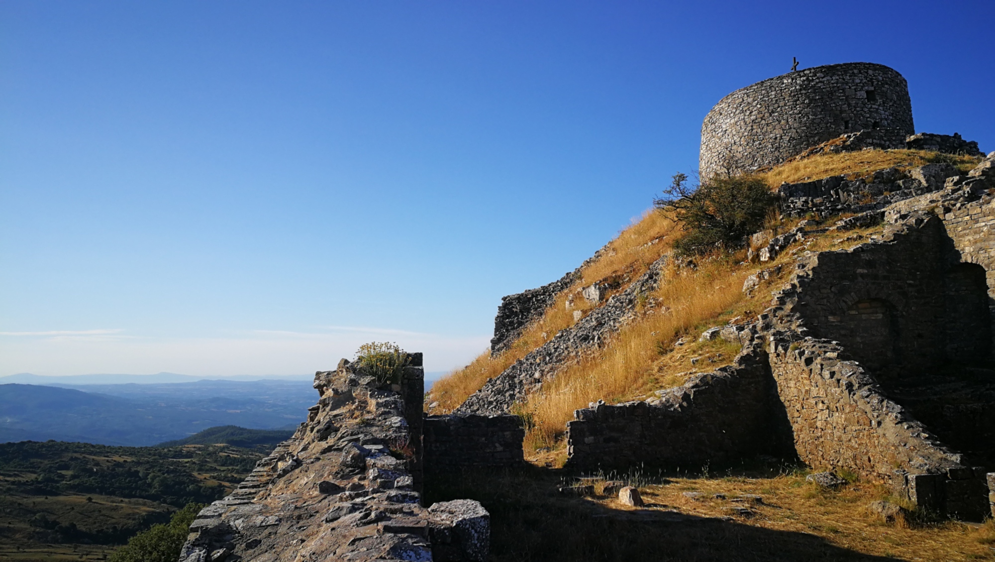
We then set off from Abbadia San Salvatore, one of the most tourist and well-known centers in the area, named after the ancient Abbey built in the Lombard era. We head toward Piancastagnaio, to the south, taking a variant on a dirt road that will immediately plunge us into the green woods that cover the slopes of the Amiata. About five kilometers and here we are under the fortress of the village.
The descent becomes steep until we reach the valley floor; at the height of an industrial area, we turn right for a series of digressions onto dirt tracks and minor roads that will put us back on the road route beyond Castell’Azzara.
Here, we turn left and then keep the right, following the signs for Piancastagnaio and not for Santa Fiora, which we will reach anyway after 13 km by keeping left at the following crossroads. Shortly after Santa Fiora the road starts climbing again and then descends again in the direction of Roccalbegna.
We will not get to the village because just before (about 11 km after leaving Santa Fiora) we will take a right along a dirt road that will take us to Mount Labbro, to go to the David Lazzaretti Fortress of Giurisdavici, a religious sect considered subversive and suppressed by force in 1878. The road goes up to 1110 m, the “Cima Coppi” of the whole itinerary (the summit of Mount Labbro is at 1190 m).
We begin a long descent that will take us to Arcidosso, to Castel del Piano and finally to Seggiano, a possible second stage point in our loop.
Starting again from Seggiano, we break away from the ring on the road for a digression onto minor roads and dirt roads that will take us back into nature along the slopes of the Amiata. We cross the Orcia River and take a right to tackle the last two climbs. The first will take us to Radicofani, topped by the fortress of Ghino di Tacco, a famous brigand of the mid-13th century. The last stretch descends to the valley floor of Paglia and then climbs up the opposite side, touching 915 m altitude and finally closing the loop at Abbadia San Salvatore.