Lunigiana Gravel

The Lunigiana Gravel is a multi-stage itinerary you can tackle in bikepacking style riding Gravel or E-Gravel bicycles, which runs in a circular mode (clockwise) throughout the Lunigiana region.
The proposed trail starts from Pontremoli. Alternatively, another convenient access option could be Aulla; both towns are in fact easily accessible from the A15 highway or by train via the Parma-La Spezia line. This itinerary is circular and everyone will be able to start wherever they prefer.
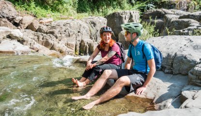
The Lunigiana Gravel is a great loop, sober and genuine, but also wild and never dull. In its 210 kilometers it will take us past medieval villages, castles, streams to dive into, thermal pools, rock tunnels, ridges and endless views.
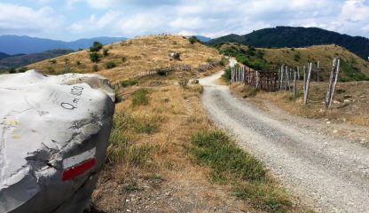
An itinerary whose appearance, vegetation and accent change prodoundly every 30 kilometers, so much so that it can be divided into 3 distinct parts; the one to the Northeast is made up of ancient streets and agile roads that will allow us to connect the most beautiful medieval villages in the area; the one to the South, tougher and more rugged, where trained legs will be needed to overcome the exciting ups and downs through the severe peaks of the Apuan Alps; and the one further West where we will climb in altitude until we reach the gentle ridge of the Ligurian Apennines with its Alta Via, in a solitary and wild environment but which will reassure us with its airy views from the hinterland to the sea.
There are no portage stretches (meaning bikes on our shoulders) but only a few short stretches that may force you to push the bike by hand for no more than 50 meters.
However, it is important to point out that in Lunigiana the unpaved roads become dirt roads at times even rough and the rolling hills become mountains, so a fitting with tubless tires and a generous section, from 40" upwards, as well as agile ratios is recommended. There are no trail markers on the route, so it is necessary to download the GPX track.
A few proposals for the stages
Two-Day Trail:
- Pontremoli-Fosdinovo: 120 kilometers x 3250 difference in altitude
- Fosdinovo-Pontremoli: 90 kilometers x 2000 difference in altitude
Three-Day Trail:
- Pontremoli-Fivizzano: 70 kilometers x 1650 difference in altitude
- Fivizzano-Aulla: 75 kilometers x 2000 difference in altitude
- Aulla-Pontremoli: 65 kilometers x 1600 difference in altitude
Four-Day Trail:
- Pontremoli-Pontebosio: 50 kilometers x 1160 difference in altitude
- Pontebosio-Equi Terme: 50 kilometers x 1300 difference in altitude
- Equi Terme-Podenzana: 56 kilometers x 1560 difference in altitude
- Podenzana-Pontremoli: 54 kilometers x 1230 difference in altitude