Towns and villages
Elba Island

Elba Island
An island that bears the traces of every culture that has crossed the Mediterranean
Elba is the largest island in Tuscany, extending along 147 kilometers of coastline and offering visitors incredible variety. From golden beaches to those that nere (black) given the presence of iron, to mountain itineraries taking in villages that overlook the sea. Elba is also an ideal destination for lovers of sports and the outdoors. Set off on a journey to discover its many treasures and beauty.
Brief history of Elba Island
There's not a single civilization in the Mediterranean that hasn’t left behind traces on Elba Island. Nature, art and a thousands-years-old culture are embraced in a 224 square meter microcsom, creating a truly unique atmosphere and extraordinary setting marked by the interactions of so many different peoples. According to mythology, Jason stopped at Porto Argon, today Capo Bianco, during his adventurous search for the Golden Fleece, and, as Virgil writes in Aeneid, it was from the same port that 300 young Elba Islanders set sail to help “Pious Aeneas” in the difficult fight against the Rutuli.
For the Etruscans, Elba was an inexhaustible source of riches: by the 8th century, the mines were already being exploited and iron was exported to the whole of the Mediterranean Basin, garnering immense wealth. There were furnaces that day and night melted the minerals in a tall blaze and which, as Aristotle claims, were the origin of the name Aethalia (flicker), attributed to Elba by Greek explorers. The five centuries of Etruscan rule left us with several necropolises, remains of some of the furnaces and numerous “hill villages,” nestled within a unique scenery.
With the decline of Etruscan power, the Romans inherited the iron and steel industry, but they also exploited the island’s granite deposits and discovered the curative muds at the Terme di San Giovanni, the splendours of the landscape and the high-quality wines. Pliny the Elder called Elba “the Island of good wine”. This production lead to immense traffic, with endless ships stopping on the island to collect amphoras: many of these are today conserved in the Archeological Museums in Portoferraio and Marciana, and, together with incredible artifacts coming from the sea, they narrate the history of exploration in the ancient era. In the most picturesque gulfs, visitors can find the grandiose patrician villas of Linguella, Grotte, and Capo Castello, joyful places today just as they were in the past.
In the Middle Ages, it was the Maritime Republic of Pisa that took the lead in exploiting the iron and granite mines on Elba: most of the columns embellishing Piazza dei Miracoli were cut by talented stonemasons from San Piero. Many traces remain from the era of Pisa’s rule, including the elegant Romanesque churches, the tower of San Giovanni in Campo, built on top of an enormous granite boulder, and most impressively, the Pisan Fortress of Marciana and the Volterraio Castle, a lookout over the mountains and sea.
By 1548, the Medici had their turn to rule the island: Cosimo I built the fortified city of Portoferraio, a true gem of military city planning. The harmony between the sea, land and buildings was so perfect that the new city was called Cosmopoli, a “cradle of civilization and culture, an example of balance and rationality”.
Immediately following this, the Spanish occupied Porto Azzurro and built the imposing Forte San Giacomo, today the seat of the prison, as well as several chapels and the evocative Monserrato Sanctuary, nestled on a somber “Dolomite-like” mountain. In the 18th century, Elba was fought over by the Austrians, Germans, English and French, with chaotic diplomatic negotiations or stubborn battles, until it was given in “full ownership and sovereignty” to Napoleon Bonaparte. During the 10 months the French leader governed the island, he had an important impact: he built streets, reorganized the mining economy and increased the production and exportation of wine. A deconsecrated ancient church was transformed into an elegant theatre that, returned to its ancient splendour after a skilled restoration, now hosts important cultural programs. Upon returning to France for those 100 fateful days, Napoleon left behind two residences, today the seat of the National Museums and visited every year by the thousands.
How to get there and what to see on Elba Island
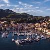
Elba Island can be reached by boat, departing from the port of Piombino. From here, there are connections by sea to Portoferraio, Rio Marina and Cavo. You can also reach the island by plane, landing at the airport in La Pila in the municipality of Campo nell'Elba.
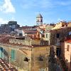
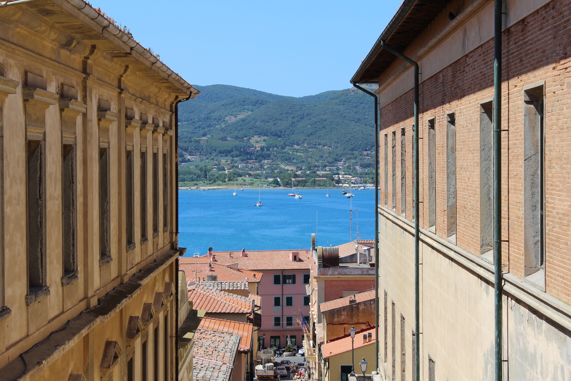
To discover the true essence of Elba, just get lost in the streets of its villages. In addition to visiting Portoferraio, the largest town in terms of population on the island, don't miss Marciana, the oldest Elban center that still retains a medieval structure.
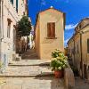
Porto Azzurro, on the other hand, is a pretty fishing village that's also known for the Sanctuary of the Madonna di Monserrato. It was built in 1606 by the Spanish governor Pons y Léon, dedicated to the cult of the Black Madonna that's venerated in Spain in the sanctuary of Montserrat.
If you want to admire the view from the highest peak of the Island of Elba and take a souvenir photo, get on the cable car in Marciana in the locality of Pozzatello. You will find yourself immersed in the nature of Monte Capanne, an ideal destination for those wishing to undertake trekking itineraries.
The mining quarries in the Rio Marina area on the east coast are particularly fascinating. Here, you'll find the Elba Island Mining Park which organizes guided tours by train or jeep in search of pyrite and hematite samples.
Elba Island can be reached by boat, departing from the port of Piombino. From here, there are connections by sea to Portoferraio, Rio Marina and Cavo. You can also reach the island by plane, landing at the airport in La Pila in the municipality of Campo nell'Elba.
To discover the true essence of Elba, just get lost in the streets of its villages. In addition to visiting Portoferraio, the largest town in terms of population on the island, don't miss Marciana, the oldest Elban center that still retains a medieval structure.
Porto Azzurro, on the other hand, is a pretty fishing village that's also known for the Sanctuary of the Madonna di Monserrato. It was built in 1606 by the Spanish governor Pons y Léon, dedicated to the cult of the Black Madonna that's venerated in Spain in the sanctuary of Montserrat.
If you want to admire the view from the highest peak of the Island of Elba and take a souvenir photo, get on the cable car in Marciana in the locality of Pozzatello. You will find yourself immersed in the nature of Monte Capanne, an ideal destination for those wishing to undertake trekking itineraries.
The mining quarries in the Rio Marina area on the east coast are particularly fascinating. Here, you'll find the Elba Island Mining Park which organizes guided tours by train or jeep in search of pyrite and hematite samples.
The beaches of the Island of Elba
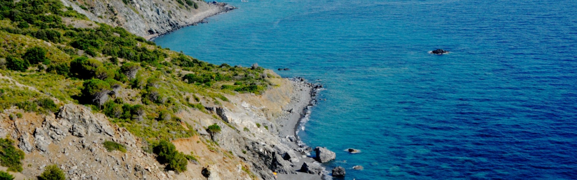
Elba Island is full of wonderful and very different beaches. Those who love soft sand can choose the beach of Fetovaia in the municipality of Campo dell’Elba. It's perfect for those with children and those in search of a beach with services.
The beach of Marciana Marina, located on the town's seafront, is never too crowded and is close to public gardens that are useful for shelter during the hottest hours of the day, and the main services.
The long and sandy beach of Cavoli has a shallow seabed and is also suitable for families, while those who prefer pebble beaches can discover the beach of Sansone.
Finally, Marina di Campo offers fun opportunities for your free time. Here, you'll find a diving center, a sailing and windsurfing school, and also kayak excursions are organized.
Sport and nature
Elba Island, with its hills and breathtaking colours, is the perfect place for excursions by mountain bike or bicycle. Many paths can also be covered on foot, characterized by pine forests, farms and charming views. By trekking along these routes, it's possible to savour every place, and stop in front of the incredible wonders of nature to contemplate the scenic spectacle that the island offers its visitors.
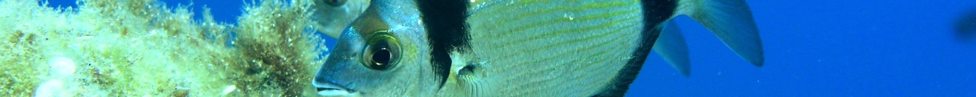
The coast of Elba is also a paradise for snorkelers. Scuba divers can spot fish, lobsters and abandoned wrecks in the sea and coves.
Elba Island, with its hills and breathtaking colours, is the perfect place for excursions by mountain bike or bicycle. Many paths can also be covered on foot, characterized by pine forests, farms and charming views. By trekking along these routes, it's possible to savour every place, and stop in front of the incredible wonders of nature to contemplate the scenic spectacle that the island offers its visitors.
The coast of Elba is also a paradise for snorkelers. Scuba divers can spot fish, lobsters and abandoned wrecks in the sea and coves.
Events
During the Walking Festival, you can admire the thousand faces of Elba Island. In spring and autumn, take part in guided tours and hiking events as visitors can discover the treasures of the area with birdwatching and walks through history.
The historic Palio Remiero Elbano is a tradition that has been carried on for centuries: the teams from Elba compete against each other on the Sundays of June and July.
In Capoliveri in October, the Grape Festival takes place. Locals are very passionate about this event that pays homage to the grape harvest and the authentic flavours of Elba Island.
Typical dishes and products
Elba Island vaunts a great food and wine tradition thanks to quality agriculture and excellent products such as oil, honey and wine. Here, wines are made such as dry Ansonica, perfect for pairing with desserts and shellfish, or the Rosso Riserva DOC that's ideal for game. However, the undisputed king of wine production is the Aleatico Passito DOCG, to be tasted with schiaccia briaca, a typical recipe from Elba that's made with raisins and pine nuts.
Those who love fish must absolutely taste sburrita, a soup of cod and herbs. Don't miss gurguglione, a sort of stew made with vegetables, peppers and aubergines.
info
Information
What’s nearby?
Must-see places, stage-by-stage routes, events and tips for your trip


")


Elba and Tuscan Islands
Gorgeous pearls for an uncontaminated and protected marine jewel
Show more
arrow_forward
Elba and Tuscan Islands
Gorgeous pearls for an uncontaminated and protected marine jewel
Go to the area
arrow_forward

