
A journey through Tuscany, in search of the ways of the earth
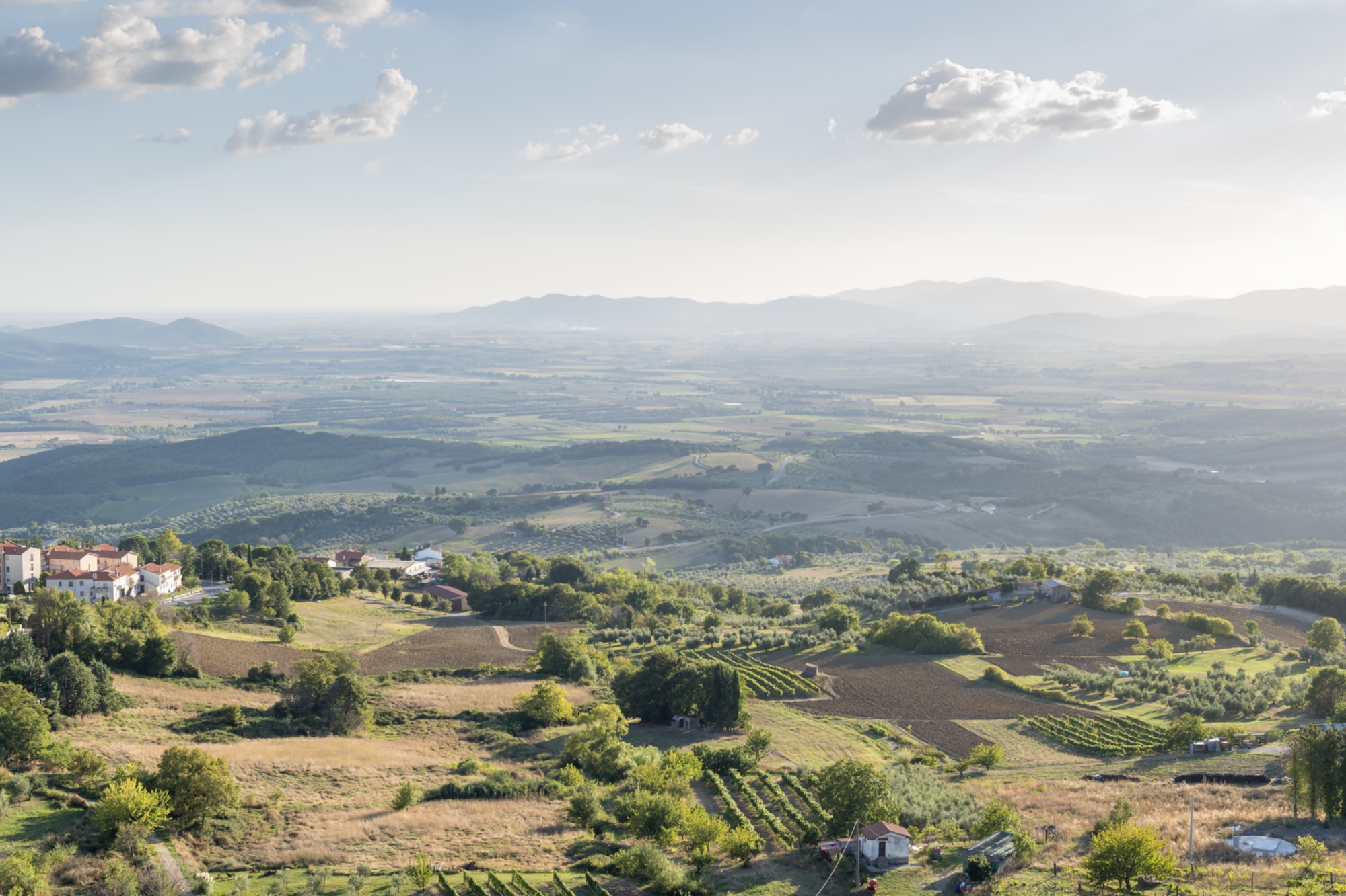
Beaches bordered by evergreen pinewoods; clumps of Mediterranean scrub that alternate with meadows, vines and olive trees; and higher up, the rough and stony summits of mountain ranges. These are the Metalliferous Hills, a slice of Tuscany which, surrounded by the provinces of Livorno, Pisa, Siena and Grosseto, comes together, in its limited scope, to make a place of endless natural variation and rich cultural heritage.
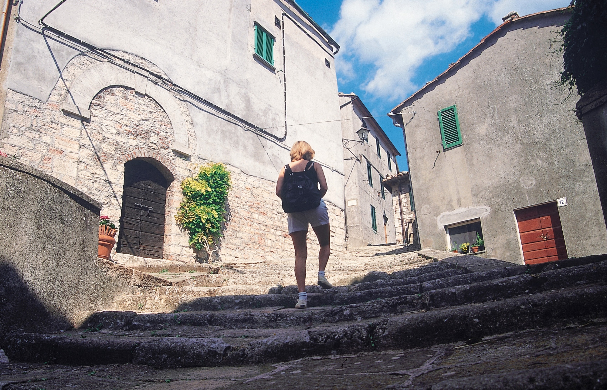
These hills offer a vivid cross-section of the veins of metal ore that have nestled here over the centuries. From the times of Etruscan settlements to our own century, the economic activity of this territory has always been based on the extraction of metals, such as copper, iron and silver, resources in which the subsoil of the area is especially rich. Even today this mineral history can be read through the archaeological finds left over the centuries by the Etruscan, Roman and medieval civilizations. Mines, iron and steel furnaces and old ironworks are spread around the coastal areas, while picturesque medieval villages decorate the tops and slopes of these hills.
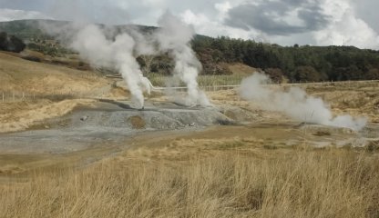
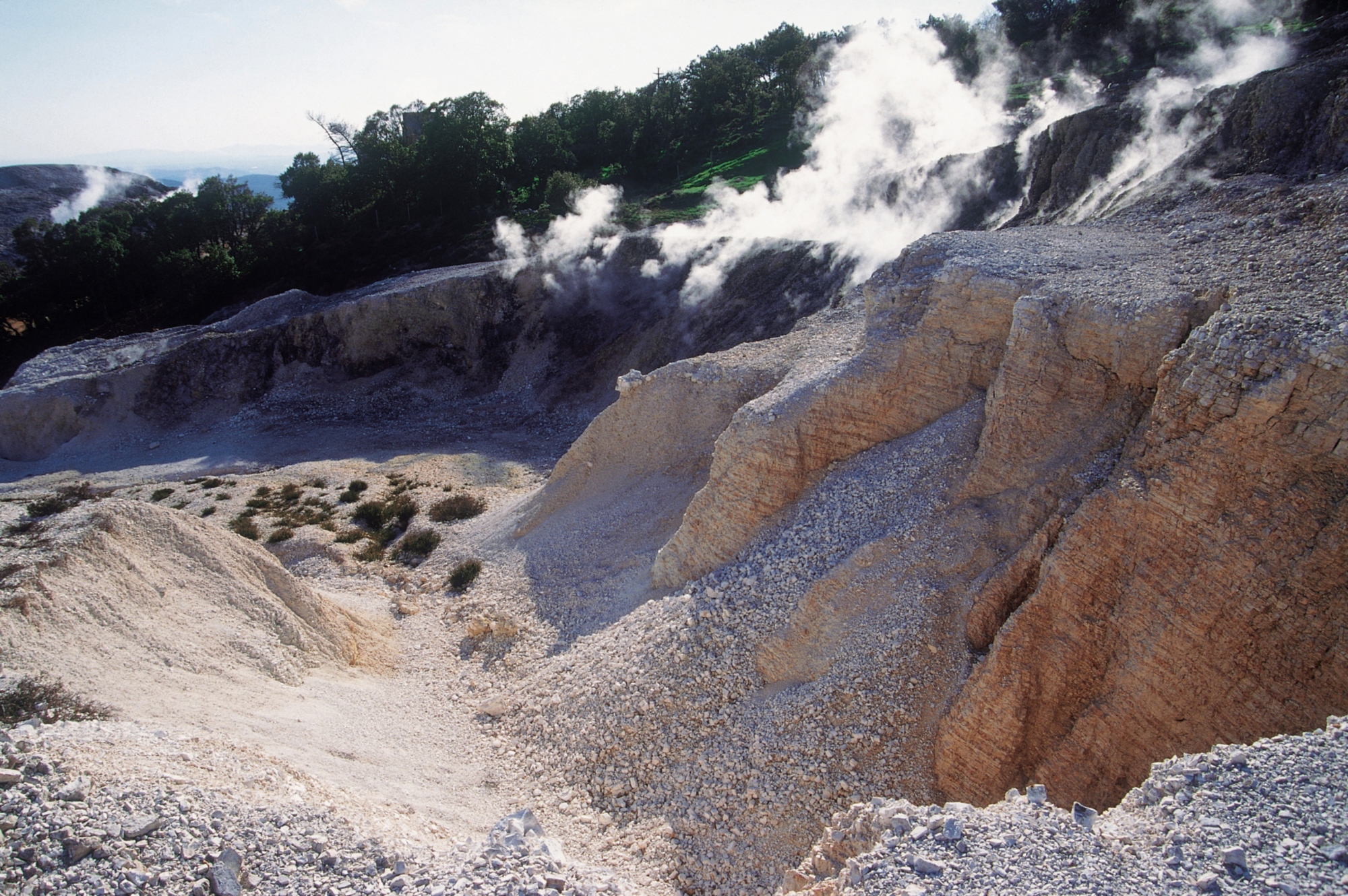
The placid scenery changes around the spectacular geothermic fields which extend from Larderello in the province of Pisa to Monterotondo Marittimo in the province of Grosseto. Here the vegetation gives way to sulphuric gases and fumaroles, puffs of aqueous vapour and gases that escape from the numerous fissures in the soil. The smoky craters and the puddles of boiling mud, defining features of this wild and barren land, give the landscape an almost infernal aspect, leading certain historians to believe that this place was the inspiration for a passage in the first canticle of the Divine Comedy. The point of departure of each excursion must be reached by car.
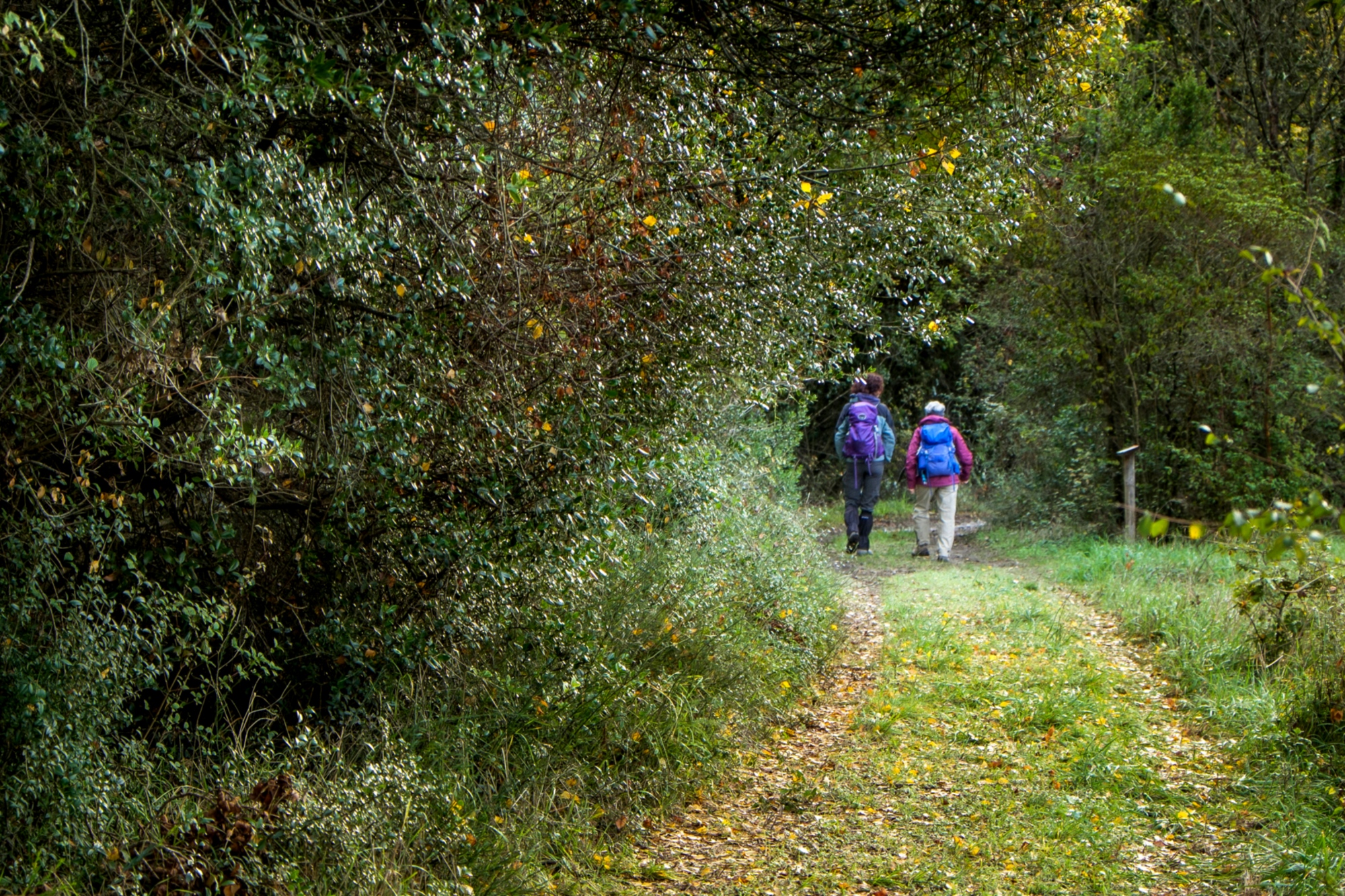
Our journey begins at the south-western edge of the province of Pisa, in the Berignone Nature Reserve, between the districts of Volterra and Pomarance. This protected area, once a deposit for combustible timber from the saltworks of Volterra, takes the form of a barrier of holly oaks and maple trees which extends uninterrupted for about 2,000 hectares. Thanks to its density of woodland, for a long time these areas offered refuge to the first groups of partisans, who were helped to hide by the loggers, charcoal-burners and farmers. On the southern fringe of the reserve, the thick vegetation of the Berignone frames the natural pools between the rocks of the river Cecina, while a path leads us though the wood to exactly one of these watery mirrors, the Masso delle Fanciulle, a swimmable stretch of the river where in the past, some say, young women would habitually bathe, far from prying eyes.
Having left the car at the entrance to the reserve, we pass the barrier and go on until reaching a place allotted to the small farm of Capannone, in the past somewhere where the few inhabitants of the area could buy basic necessities for life in the woods. We start walking along dirt track 4B and cross the Sellate stream, and turning right we follow a climbing path, then take another little road that runs off to the right. We follow this rocky stretch until getting to the ruins of the Casinieri farm, an old landmark of the partisan groups that operated in these regions, and we continue to the viewpoint that looks over the Cecina valley and the Pavone stream. We rejoin the path and head downhill until arriving in the precincts of Masso del Fanciulle. At this point we retrace our steps until the path splits, and we take the left, along a slightly uneven route, until reaching the equipped area again.
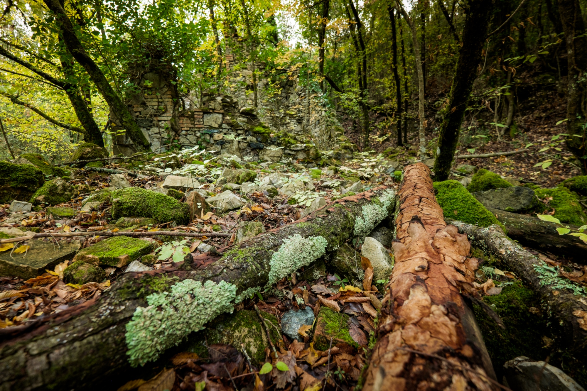
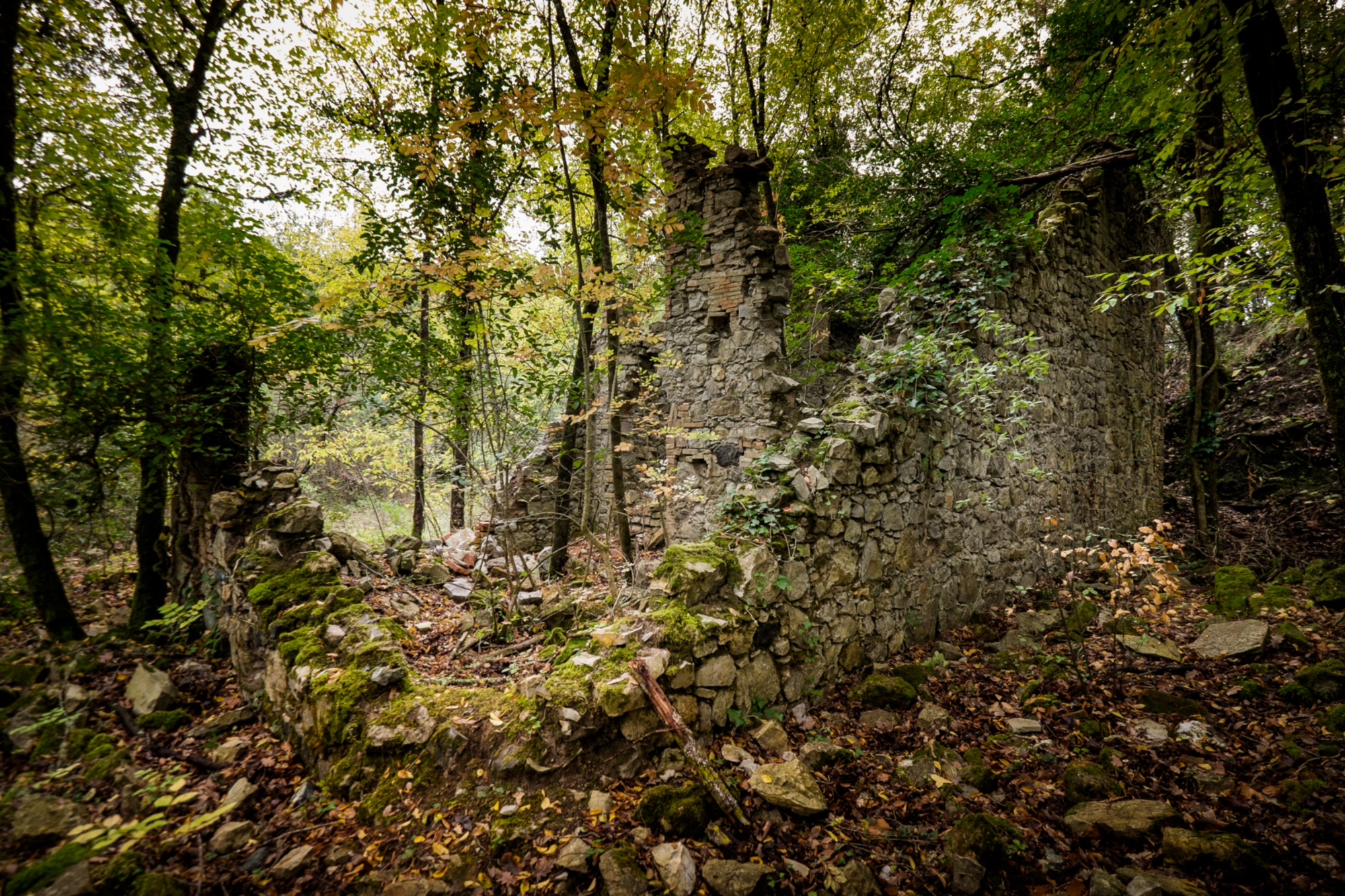
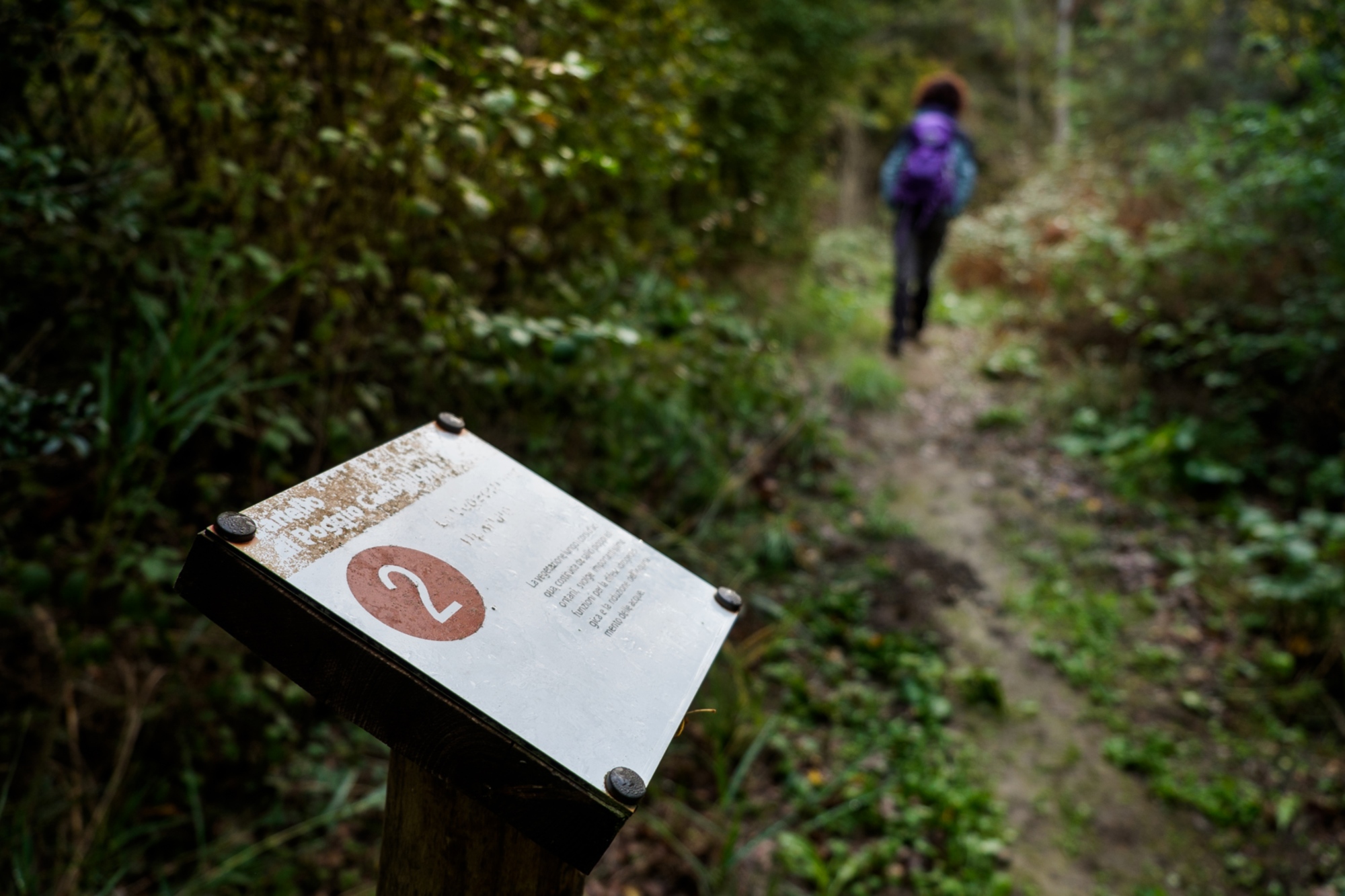
Our journey brings us to the Caselli Monterufoli Nature Reserve, a place of great natural and historical importance, situated between the coast and the hills in the south of the province of Pisa. The landscape in this area of around 5,000 hectares is almost completely covered with dense undergrowth, civilised only by patches of flowers, garrigue and clear runnels of water. In this thick vegetation, where it is not uncommon to catch a sight of fallow deer, roe deer and wild boar, lie the remains of Monterufoli's mineral history. Always noted for the presence of veins of copper and lignite, the zone is in fact home to old abandoned buildings with connections to the mining industry.
The route begins at Podere Cerbaiola around three kilometres from the hamlet of Libbiano. We go past a traffic barrier, start upon a little road on the left, and take path no. 9 (according to the Unione Montana). In the greenery we catch sight of old ruined buildings and traditional low stone walls as we walk this section, sometimes steep, until the path, skirting round some unstable ground, leads us to a space almost bare of vegetation. We plunge again into the wood and follow the path until the left bank of the Trossa stream. Hugging the river, we climb again until we reach a junction and bear to the right, following a constant descent. Continuing at a height, we rise steadily along this stony stretch of path, flanked by the ruin of an old mining complex that peeps out from the undergrowth. Having left the track to briefly follow the path of a controlled fire, we take a road on the left until coming again to our starting point.
Plumes of vapour that escape from slits in the stone, the smell of sulphur and strange sulphurous wells: the third stage of this journey is dedicated to the geothermic phenomena of the Colline Metallifere's eastern range. A path lined with explanatory signs takes us from Sasso Pisano to the Biancane Nature Park in Monterotondo Marittimo. Here the typical Maremman landscapes leave space for the fuma roles, the natural pools and the unique biancane, brilliant white rocks that alternate with geothermic fluids, in a terrain that assumes a range of colours from purple to bright red to yellow ochre.
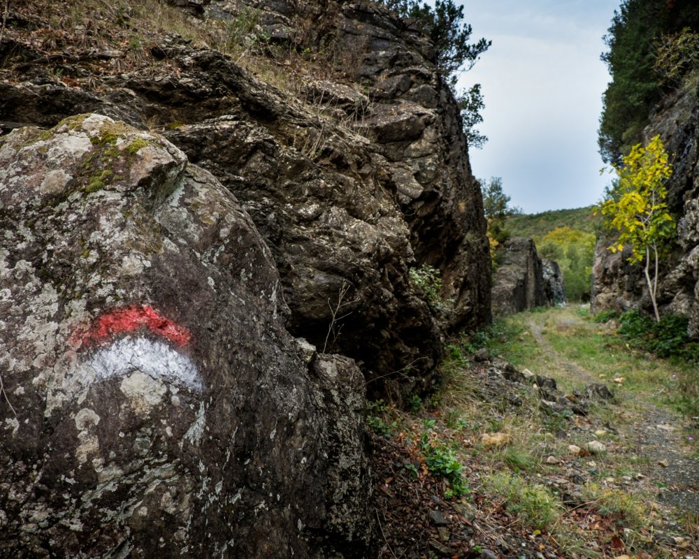
Leaving the car a little outside the town, we walk along the main street of the village of Sasso Pisano, at the end of which we embark on a dirt road marked with red-and-white signs. Climbing all the time, we walk through a wood to reach the other side of the hill. Having passed by an abandoned mine, we keep to the right of the two grafts that we come across, and proceed down a small cavity called the Buca del Papa. We follow the path until it comes to a clearing that separates the two villages, where we can see the first fumarole. Going a little to the left, we take the main road that leads to Monterotondo, in the Parco delle Biancane. Here a circuit will allow us to see the continuous boiling of the endogenous gases and to enjoy the panorama of the Cornate and the soft ridge that runs all the way to the Tyrrhenian Sea. The walk finished, we get back on the route until the crossroads, and walk along the main path for Sasso Pisano. Between fumaroles and the smaller biancane, the route, made up of steep slopes and sharp descents, passes close by a small natural lake before bringing us to a new crossroads. We therefore turn left and, not far from a mound encircled by little streams, turn right, heading north, to arrive again that the road that goes through Sasso Pisano.
Plumes of vapour that escape from slits in the stone, the smell of sulphur and strange sulphurous wells: the third stage of this journey is dedicated to the geothermic phenomena of the Colline Metallifere's eastern range. A path lined with explanatory signs takes us from Sasso Pisano to the Biancane Nature Park in Monterotondo Marittimo. Here the typical Maremman landscapes leave space for the fuma roles, the natural pools and the unique biancane, brilliant white rocks that alternate with geothermic fluids, in a terrain that assumes a range of colours from purple to bright red to yellow ochre.
Leaving the car a little outside the town, we walk along the main street of the village of Sasso Pisano, at the end of which we embark on a dirt road marked with red-and-white signs. Climbing all the time, we walk through a wood to reach the other side of the hill. Having passed by an abandoned mine, we keep to the right of the two grafts that we come across, and proceed down a small cavity called the Buca del Papa. We follow the path until it comes to a clearing that separates the two villages, where we can see the first fumarole. Going a little to the left, we take the main road that leads to Monterotondo, in the Parco delle Biancane. Here a circuit will allow us to see the continuous boiling of the endogenous gases and to enjoy the panorama of the Cornate and the soft ridge that runs all the way to the Tyrrhenian Sea. The walk finished, we get back on the route until the crossroads, and walk along the main path for Sasso Pisano. Between fumaroles and the smaller biancane, the route, made up of steep slopes and sharp descents, passes close by a small natural lake before bringing us to a new crossroads. We therefore turn left and, not far from a mound encircled by little streams, turn right, heading north, to arrive again that the road that goes through Sasso Pisano.
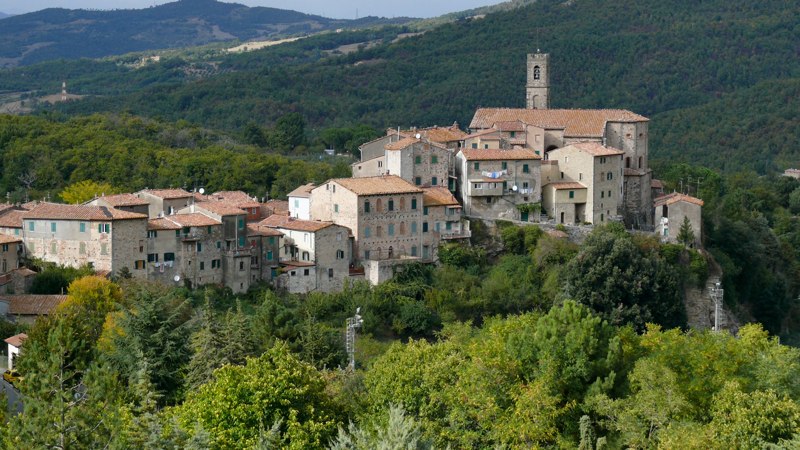
Our journey proceeds to the border between the provinces of Siena and Grosseto, up through the Cornate di Gerfalco, where nature reveals herself in all her beauty. Reaching a height of 1,060 metres, this calcareous range dominates a large part of central Tuscany, and from it we can see Siena and Monte Amiata. On the opposite side, in the Tyrrhenian seascape, a clear day will make it easy to pick out the islands of the Archipelago and even Corsica. Situated in the centre of the Cornate and Fusini Nature Reserve, this mountainous highland is genuine environmental paradise, where little shrubs, meadows, forests of turkey oak, holly oak and chestnut trees vie with the rocky slopes, partially covering them.
Our starting point is Gerfalco, the ancient mining village on the mountainside. Close to the Colonia Montana Santa Maria, a clear signpost points us on to a rocky road along the ridge that faces south-east. From here we start a gentle climb for around three kilometres, noticing the holly oak woods and the flora typical of the Cornate, before arriving not far from the summit. We pass through coniferous woods to reach one of the highest points, where we will meet one of the first cairns, curious piles of stones piled up without cement, amply distributed over the Cornate. From here we begin our rapid descent down the western slope to arrive, after little more than a kilometre, at the mine of red ammonite, the red marble used to embellish the Duomo of Siena. We continue the descent down the path, which from here becomes easier, and ignore the crossroads with path no.11, called Viottolo dei Selciani. Having arrived at Campo delle Rose, near an old mine of heaped limestone called Cava di Romano, we walk level for a bit along the white gravel road, which will take us within a stone's throw of the elegant Avveduta Chapel. We go past the building for about 300 metres and then take a little road on the left that will again bring us onto the path that we were on before reaching the village. Arriving at a crossroads, we turn right and proceed along the lane to return to our starting point.
To finish our journey we move into the valley of the Farma river, a protected area between Monticiano and Roccastrada, at the edge of the boundary between the provinces of Siena and Grosseto. The unique climate and humidity, with both a north-facing and a south-facing side, have helped to create a rather varied landscape: the poplars and willows that line the river follow woods of oak and chestnut, as well as typical species of Mediterranean scrub. The thick vegetation thins out only at the Farma's rocky banks, which have been sculpted by the current that churns the riverbed and creates the so-called Canaloni, an enchanting sequence of little waterfalls and natural pools. Even if the valley is now little inhabited, in medieval times it contained many buildings for the working of iron: ruins of mills and smithies, which got their energy from the river's current, are still visible along the banks.
Our route begins with a dirt track in front of the cemetery of the village of Scalvaia, labelled as path no.6. Having reached the first junction, we head left until we get to the fields of San Biagio, from which we continue along a series of little rises and descents until we reach Poderone. Taking the main road, we go beyond the clearing of Croce a Consoli and arrive at a junction, with a sign that reads 'Ferriera'. We take the road on the right, skirting round a chain barrier, and after a few twists and turns come to the old ironworks on the bank of the Farma, near a little strip of sand. From here the path proceeds along the mountainous left bank of the river, every so often veering away from it, until a turn to the left, marked by a double red-and-white sign, brings us to the Canaloni. We take the original path again and find ourselves on a dirt track: after about a kilometre, we take a right down a well-hidden road, marked by a cairn. We climb up into a wood and come to a little clearing, where the path divides a chestnut wood to take us, eventually, to the right-hand side of the Church of San Biagio.