
A trekking route that explores the very soul of the island of Capraia, among strawberry plants, lavender and dry stone walls
Capraia Island is one of the wonderful pearls of the Tuscan Archipelago and is part of the National Park. Particularly suitable for those who love the sea and sport, Capraia boasts enchanting coves and crystal clear waters to be admired while following one of the many hiking and trekking routes.
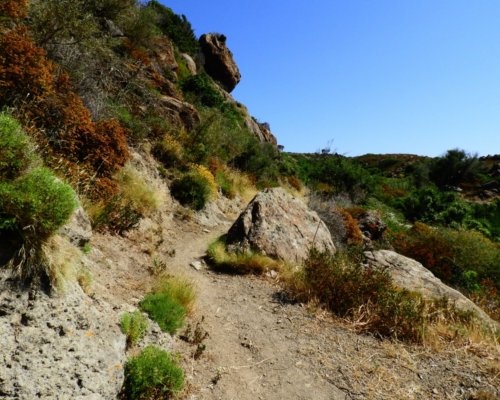
The itinerary that we propose follows the stages of the Reganico path which, from the center of the village, reaches Cala dello Zurletto, and then returns to the starting point. Along the way, you can see shrubs of marine rockrose, arbutus plants, lavender and dry stone walls, rocks colored by lichens and small caves. There are also areas where you can stop for a pleasant outdoor picnic.
We begin the journey from the main square of the town of Capraia Isola, where you can admire the church of Saint Nicola which is home to a wooden statue dedicated to the Saint that was recovered from the sea. The road becomes rough terrain once you leave the centre (it is a stretch of the road near the Semaforo that crosses the island up to Monte Arpagna). After about 1 km, near a clearing in an old quarry, the real path of the Reganico begins, so called because it once indicated the presence of water.
The path, which follows the Vado Major (the seasonal stream that in case of heavy rains becomes a waterfall in the Cala dello Zurletto), was used by the locals to reach the agricultural areas where animal breeding was also carried out.
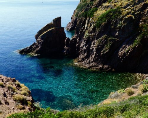
At the end of the route, go down to the small but enchanting Cala dello Zurletto (in Capraiese it is called the Asfodelo which in fact is very common in this area). The rocks, which are red and beige, reveal the most authentic soul of Capraia, the only volcanic island in the Tuscan Archipelago. If the weather permits, the crystal clear waters of this cove are ideal for a stop and a swim.
Retraced the journey backwards to return, all that remains is to continue along back to the town square.