In Maremma on the roads of cycling champions

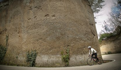
With a nervous and challenging altimetry, this route embodies all the characteristics dear to a sports cyclist, continuous ups and downs and long uphill stretches interspersed with technical descents, with steep and fast hairpin bends, where training will make the difference between suffering and having fun.
The route has signposts all through it with the abbreviation GR6, and road signs with white lettering on against a brown background, indicating the next location. For those who are less trained and who wish to try their hand on the roads of cycling champions, the technology of modern e-bikes will allow them to tread the tarmac where professional cyclists such as Mario Cipollini and Marco Pantani, who in the village of Poggio Murella had bought a house, trained in the company of Massimiliano - Max Lelli, the champion from Maremma born in Manciano and holder of an exceptional successes, with stage wins at the Giro d'Italia, winner of the Tour of Portugal in 1996, a challenger at the Tour de France for fourteen years.
From Manciano to Scansano
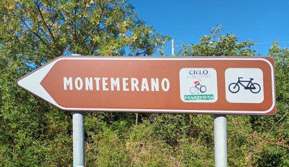
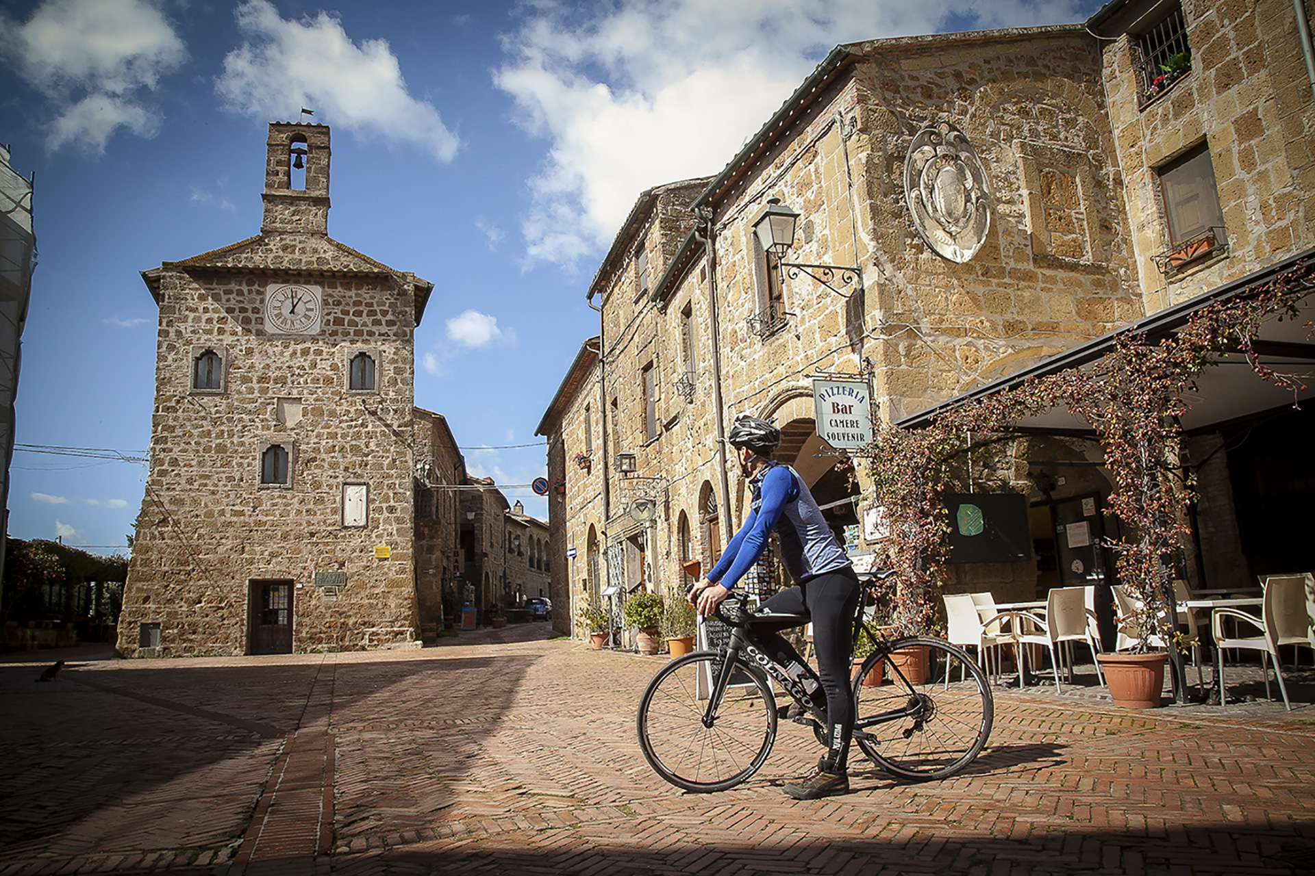
We start from Manciano by riding along Provincial Road 74 in the direction of Pitigliano, the fast curves that descend into the valley of the Fiora river seem to be built on purpose for a ride that is similar to precise, confident brush strokes. Beyond the river, a long slight slope will let us discover the wonder of the landscape overlooking Pitigliano from the viewpoint of Santa Maria delle Grazie. We enter Pitigliano by continuing, still uphill, in the direction of Sorano. Forcefully tackling the hairpin bends carved into the tuff of Provincial Road 22 we will reach Sovana crossing a tuffaceous plateau that declines toward the Parco Archeologico Città del Tufo (City of Tuff Archeological Park) where the monumental Etruscan tombs - thousands of years old - are located. Going up San Martino sul Fiora we will reach the Catabbio pass. We will continue in the direction of Saturnia along the provincial road Follonata (Provincial Road 10) as far as Montemerano. Descent and ascent alternate following the Scansanese provincial road (Provincial Road 159) which, once past the ancient farm of Pomonte, begins to climb decisively toward the highest peak of this itinerary. It is in fact Scansano - home of the famous Morellino wine and the destination of the first stage - that is entitled to be called "Cioppi peak" of this itinerary with 505 meters above sea level.
We start from Manciano by riding along Provincial Road 74 in the direction of Pitigliano, the fast curves that descend into the valley of the Fiora river seem to be built on purpose for a ride that is similar to precise, confident brush strokes. Beyond the river, a long slight slope will let us discover the wonder of the landscape overlooking Pitigliano from the viewpoint of Santa Maria delle Grazie. We enter Pitigliano by continuing, still uphill, in the direction of Sorano. Forcefully tackling the hairpin bends carved into the tuff of Provincial Road 22 we will reach Sovana crossing a tuffaceous plateau that declines toward the Parco Archeologico Città del Tufo (City of Tuff Archeological Park) where the monumental Etruscan tombs - thousands of years old - are located. Going up San Martino sul Fiora we will reach the Catabbio pass. We will continue in the direction of Saturnia along the provincial road Follonata (Provincial Road 10) as far as Montemerano. Descent and ascent alternate following the Scansanese provincial road (Provincial Road 159) which, once past the ancient farm of Pomonte, begins to climb decisively toward the highest peak of this itinerary. It is in fact Scansano - home of the famous Morellino wine and the destination of the first stage - that is entitled to be called "Cioppi peak" of this itinerary with 505 meters above sea level.
- straighten
Length87 km
-
Physical engagementMedium
-
Technical difficultyChallenging
- trending_down
Descent1360 m
- trending_up
Ascent1460 m
- vertical_align_top
Maximum altitude490
- grain
% Gravel surface0%
- grid_view
% Paved surface100%
From Scansano to Manciano
It winds downhill with views of the countryside of the pastures in Maremma, the Amiatina provincial road (Provincial Road 160) that runs through Pereta to Magliano in Toscana. Instead, it will be Provincial Road 94 that will lead us under the walls of the castle of Marsiliana from where, riding the long slight slope of Provincial Road 63, we will reach Capalbio. From Capalbio we follow Provincial Road 75 to the junction with the provincial road Sgrilla (trail marker) in the direction of Manciano. After passing through the center of scattered houses Vallerana, we will follow Provincial Road 101 (trail marker La Sgrilla) until we cross Regional Road 74. We will be on the outskirts of Manciano, but the stretch ahead is still challenging, both because of the elevation and the car traffic. From the La Sgrilla roundabout, the road seems to soar under our wheels for a few hundred meters but, having regained its "historic" ground, the regional road also regains its gentle ascent, accompanying us as far as the hill on which the village of Manciano stands.
It winds downhill with views of the countryside of the pastures in Maremma, the Amiatina provincial road (Provincial Road 160) that runs through Pereta to Magliano in Toscana. Instead, it will be Provincial Road 94 that will lead us under the walls of the castle of Marsiliana from where, riding the long slight slope of Provincial Road 63, we will reach Capalbio. From Capalbio we follow Provincial Road 75 to the junction with the provincial road Sgrilla (trail marker) in the direction of Manciano. After passing through the center of scattered houses Vallerana, we will follow Provincial Road 101 (trail marker La Sgrilla) until we cross Regional Road 74. We will be on the outskirts of Manciano, but the stretch ahead is still challenging, both because of the elevation and the car traffic. From the La Sgrilla roundabout, the road seems to soar under our wheels for a few hundred meters but, having regained its "historic" ground, the regional road also regains its gentle ascent, accompanying us as far as the hill on which the village of Manciano stands.
- straighten
Length69,8 Km
-
Physical engagementMedium
-
Technical difficultyChallenging
- trending_down
Descent910
- trending_up
Ascent810
- vertical_align_top
Maximum altitude550
- grain
% Gravel surface0
- grid_view
% Paved surface100%